
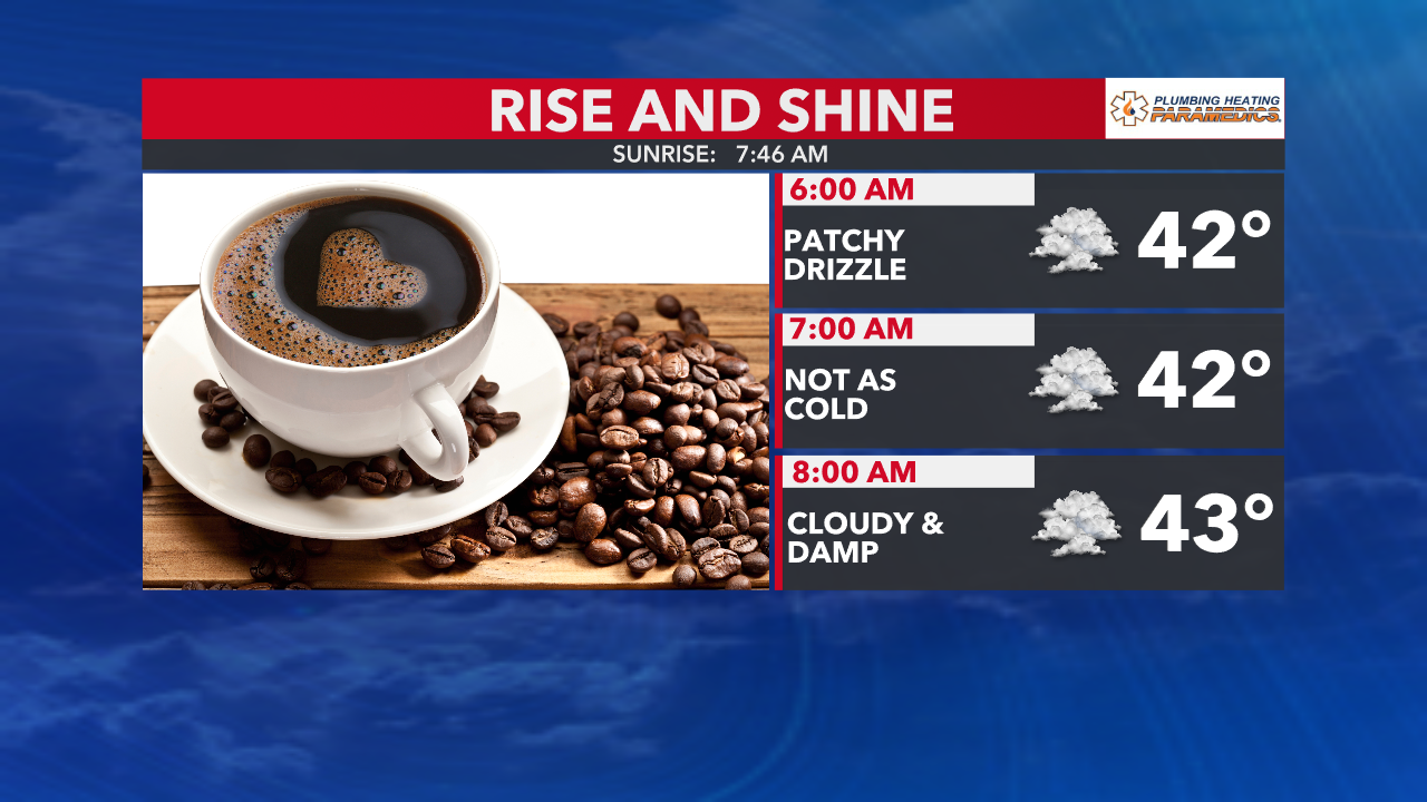
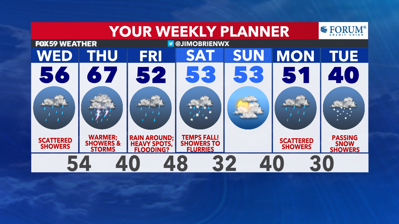
Patchy drizzle, cloudy skies and cool temperatures to open your Wednesday morning. A damp start but could be worse, as temperatures are a bit milder out-the-door with only limited fog “issues”.
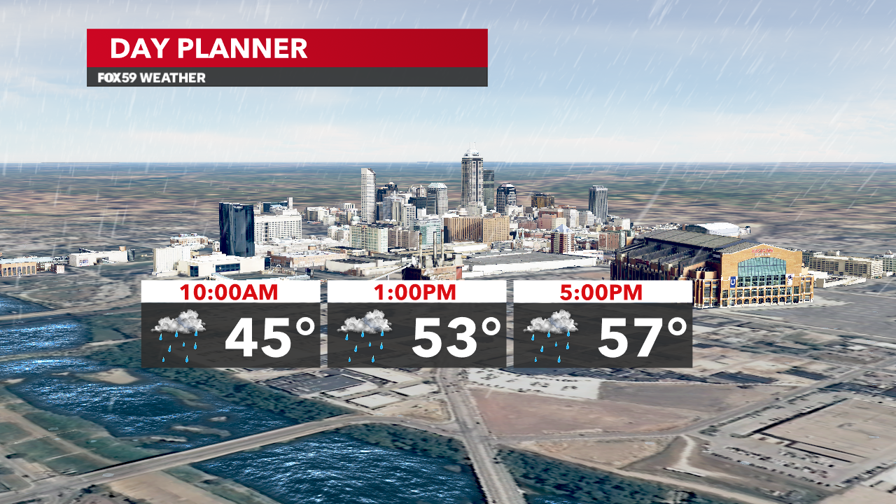
Through today, rain chances will be off and on, while temperatures steadily climb on a south breeze at 10-17 mph. Expect highs to reach the upper 50s by late afternoon. Some thunder and lightning will be possible beginning today through Friday, as the pattern deepens and becomes more unsettled.
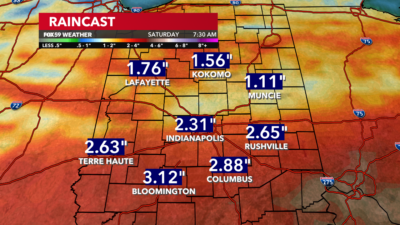
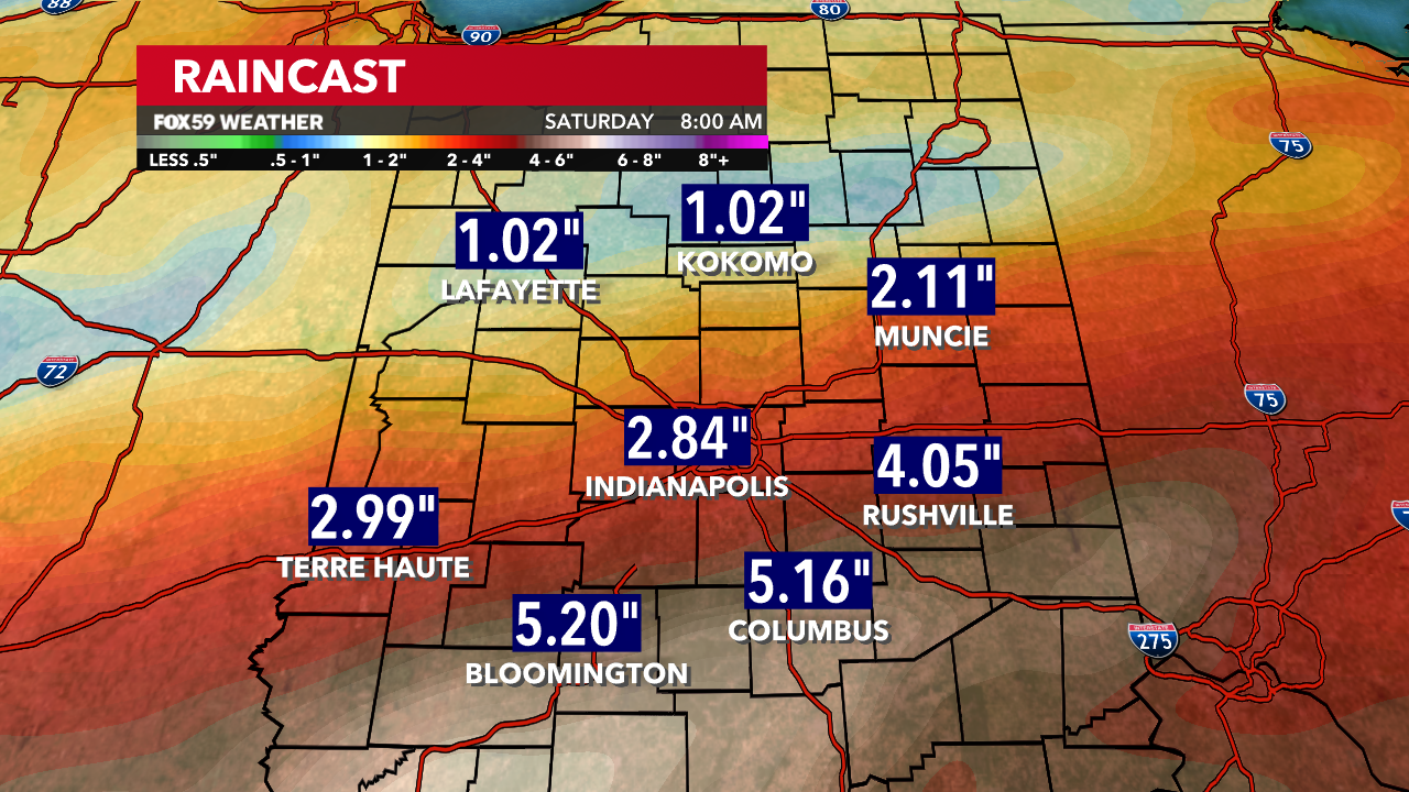
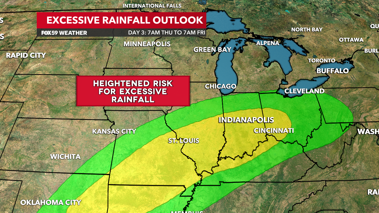
Ongoing rain chances will remain for Thursday and Friday, as the focus will turn to flooding issues into Friday morning, especially for the southern 1/2 of the state. For now, rainfall potential could range between 2″ to 4″ in spots before another round returns on early Saturday.
The weekend bring scattered showers and falling temperatures on Saturday. A breezy wind-shift will usher in colder air through the day, which could result in flurries by the evening. Sunday brings dry weather and some sunshine to round out the weekend.
Comments are closed.