
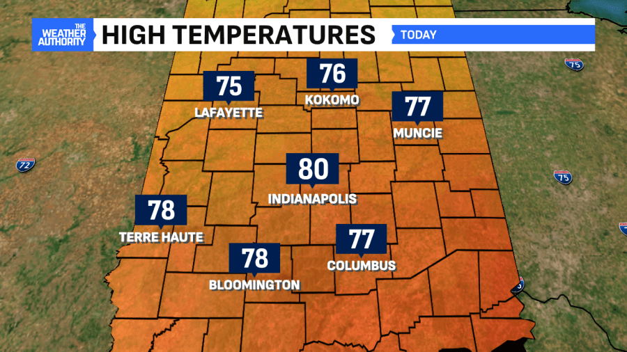
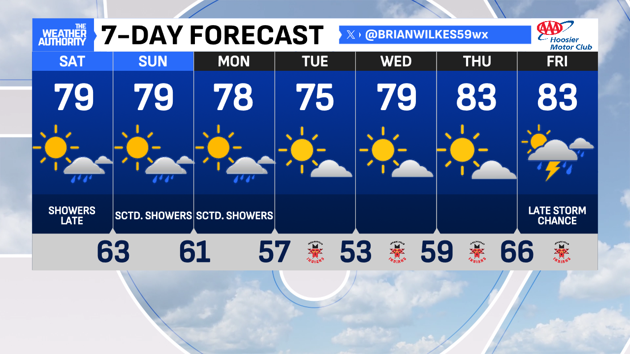
Day #13 of 2025 with a high of 80° for Indianapolis is behind us. While the temperatures won’t be budging much, we’ll continue keeping the rain chances in the forecast. Consistent temperatures are typical when we have modest levels of humidity.
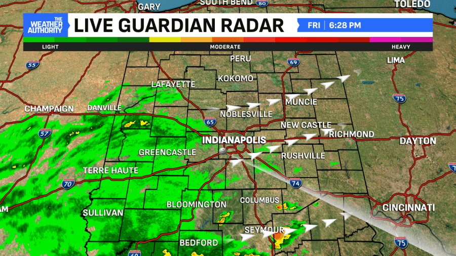
Showers are moving into the region this evening. Central Indiana misses out on the severe weather threat this go-around as that stays south into Kentucky and Tennessee. Many hometowns will stay dry but the most widespread activity tonight will be south of I-70.
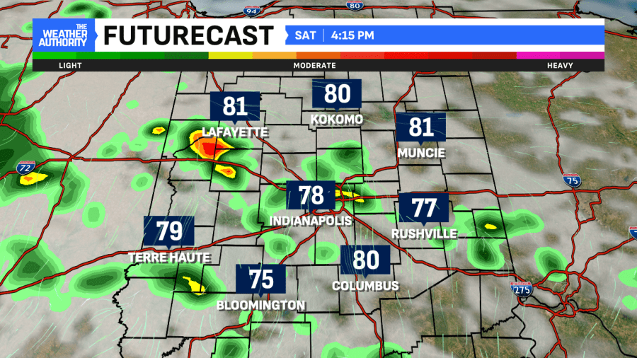
This will be the story before Midnight and fog will come after that. Thanks to the ground-level moisture and calm winds, ingredients for fog are there. It could be thick in spots through Saturday morning. Dry times are promised both Saturday and Sunday thanks to this slow-moving system
Thanks to the peak daytime heating of the day Saturday afternoon, pop-up showers and downpours are possible Saturday afternoon before turning more widespread late.
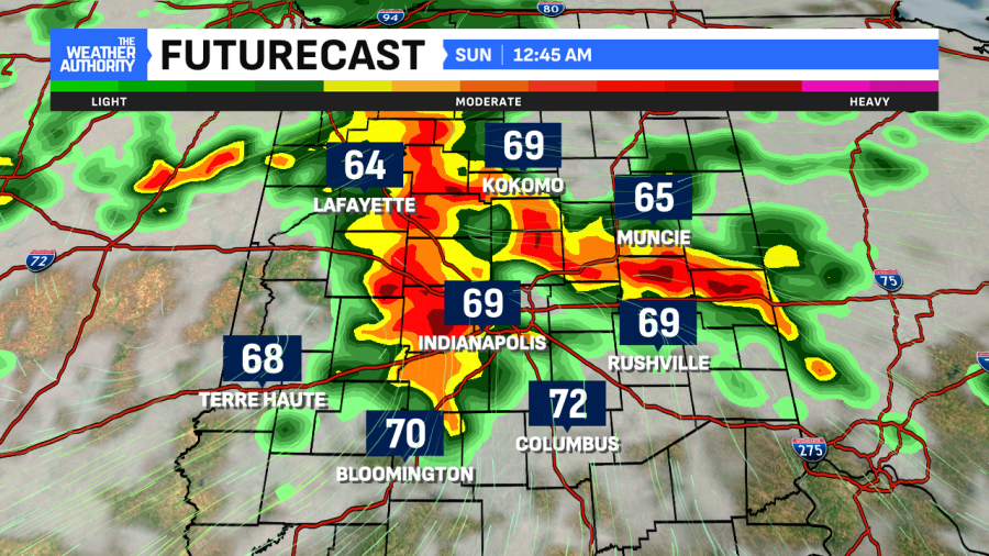
Yet another round of showers/chance of thunderstorms are expected late Sunday evening when this front finally is expected to pass. A few lingering showers are possible Monday before an extended stretch of sunny and seasonably cooler weather arrives midweek. We’ll begin to warm up by next Friday and turn more active once again toward mid-June.
Comments are closed.