
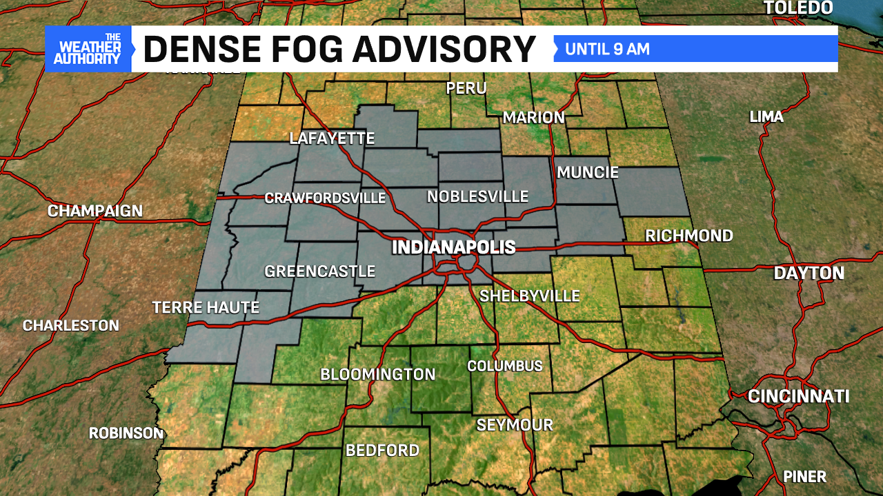
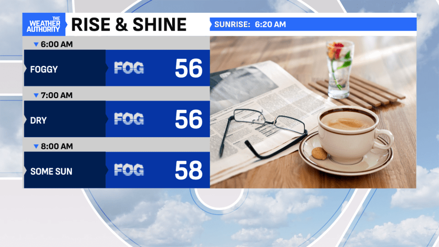
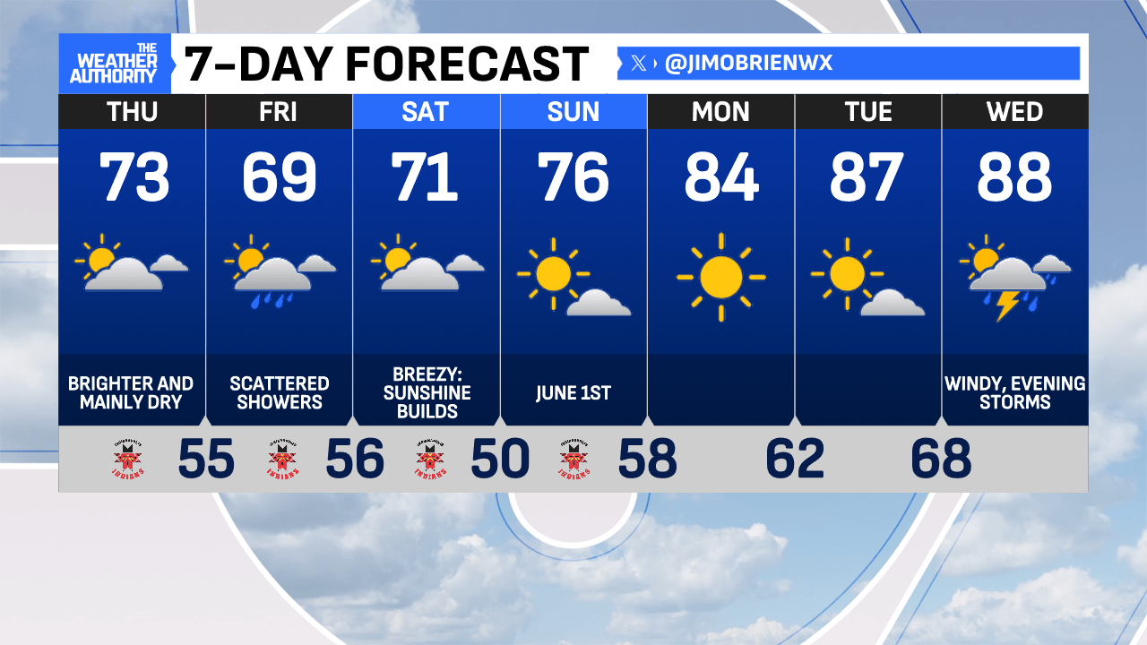
Heavy fog in spots this morning, as a dense fog advisory holds until 9 a.m.! Skies are partly to mostly cloudy and with sunrise at 6:20 a.m., expect fog to burn off steadily. Out-the-door temperatures are hovering in the middle to upper 50s, which is fairly seasonal for late May. Some extra time for the rush hour might be a good idea.
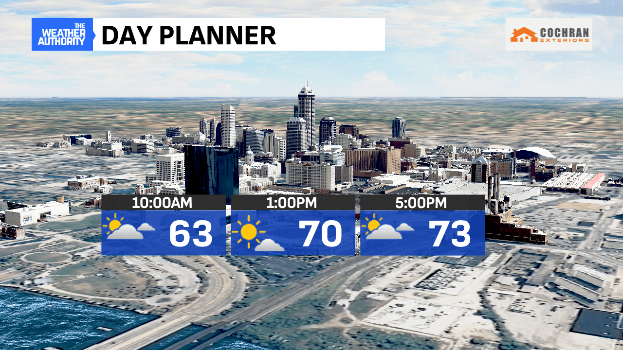
This afternoon will bring a mix of clouds and sunshine, plenty of dry time and milder air with highs reaching the lower 70s. Winds should remain fairly light from the northwest at 5-10 mph. Overall, a pretty nice day shaping up, with only a limited shower chance and likely confined to the early evening. Enjoy!
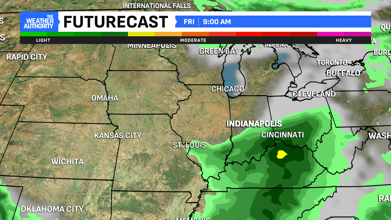
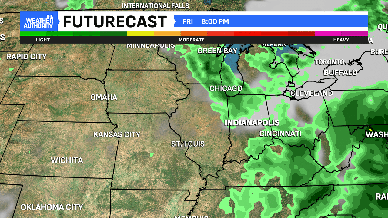
Overnight, a new wave of rain and clustered storms will drift back into Indiana. Most of this will stay well south of Indianapolis. A few showers will be around off and on, under cloudier skies throughout the day and evening.
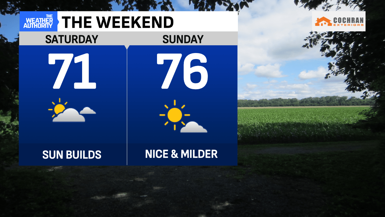
The weekend finally brings changes! Decreasing clouds and breezy conditions are expected on Saturday, as we transition into more stable air with highs reaching the lower 70s. Sunday will bring more sunshine after a cool start. A nice rise in temperatures is expected to near seasonal levels before a hotter, more summer-like pattern emerges early next week.
Comments are closed.