
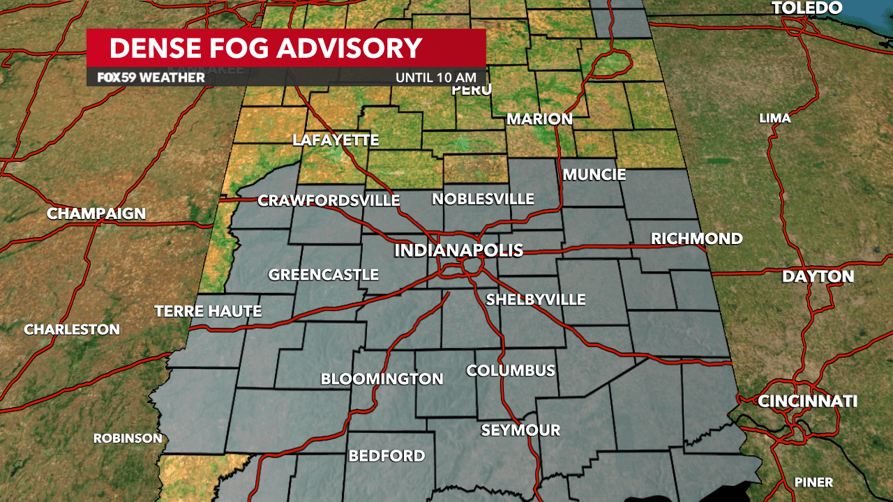
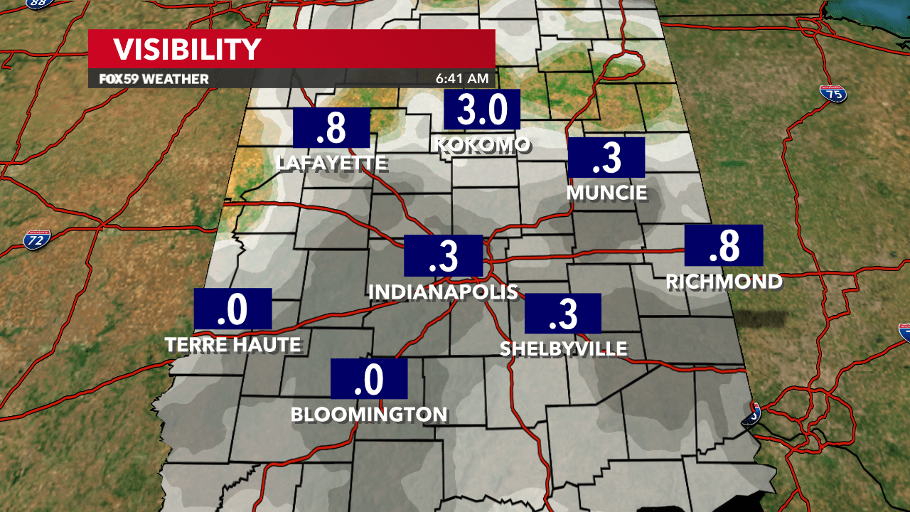
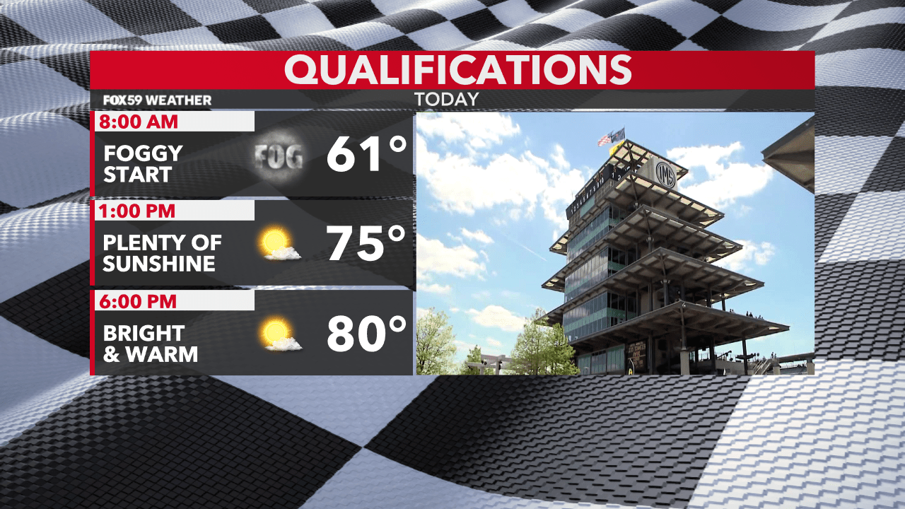
The fog was thick this morning around central Indiana. A Dense Fog Advisory was issued through 10 AM for a large portion of the state as visibilities fell below a quarter mile in several locations. The fog will continue to dissipate this morning with skies becoming mostly clear by midday.
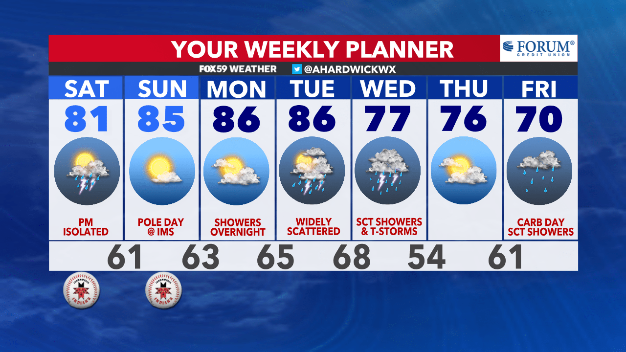
Today is going to stay primarily dry, although there is an isolated storm chance heading into the afternoon. Highs will reach into the lower 80s.
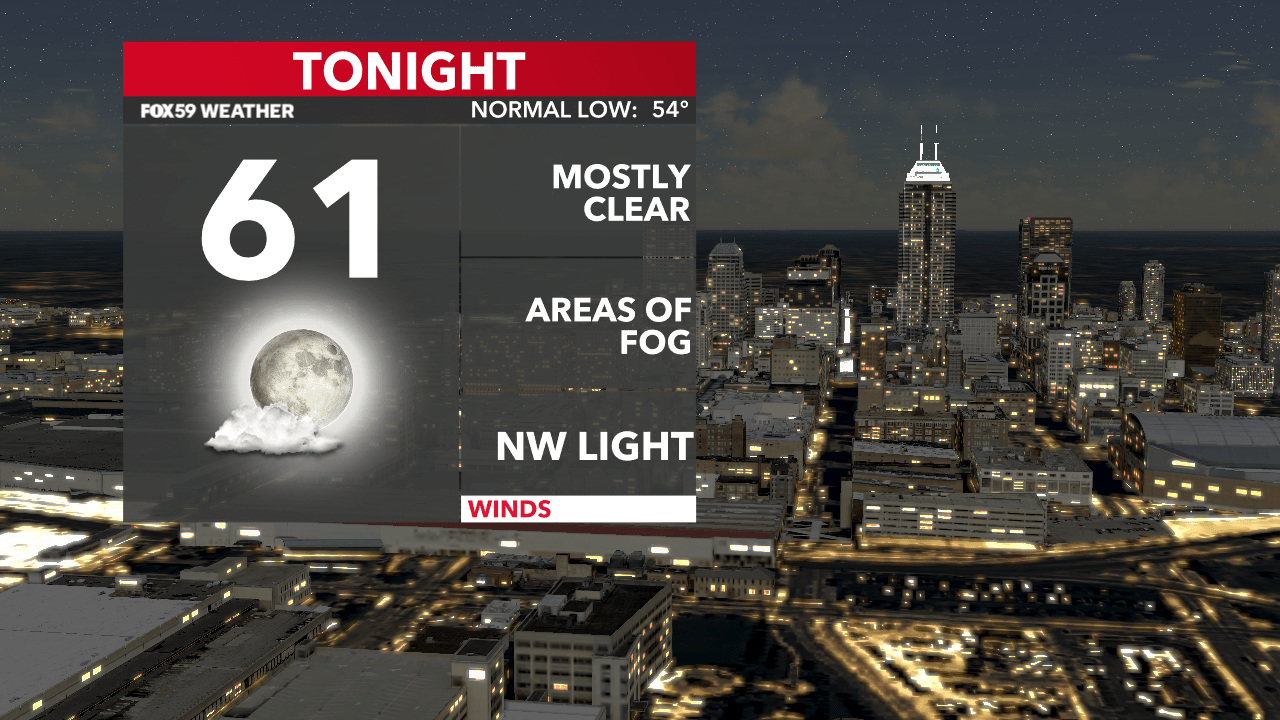
Skies are going to remain mostly clear this evening and overnight. Wind speeds will stay light as temperatures fall to the lower 60s. There is another chance for patchy fog to develop tonight and early Sunday morning.
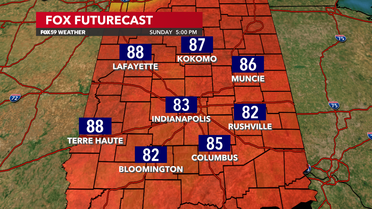
Prepare for even warmer weather on Sunday with forecast highs in the mid-80s! Dry conditions are likely with higher pressure building into the Ohio Valley. Monday is looking very warm and dry as well with potentially the warmest temperatures of the year so far! Rain chances are back into the mix late Monday night and Tuesday.
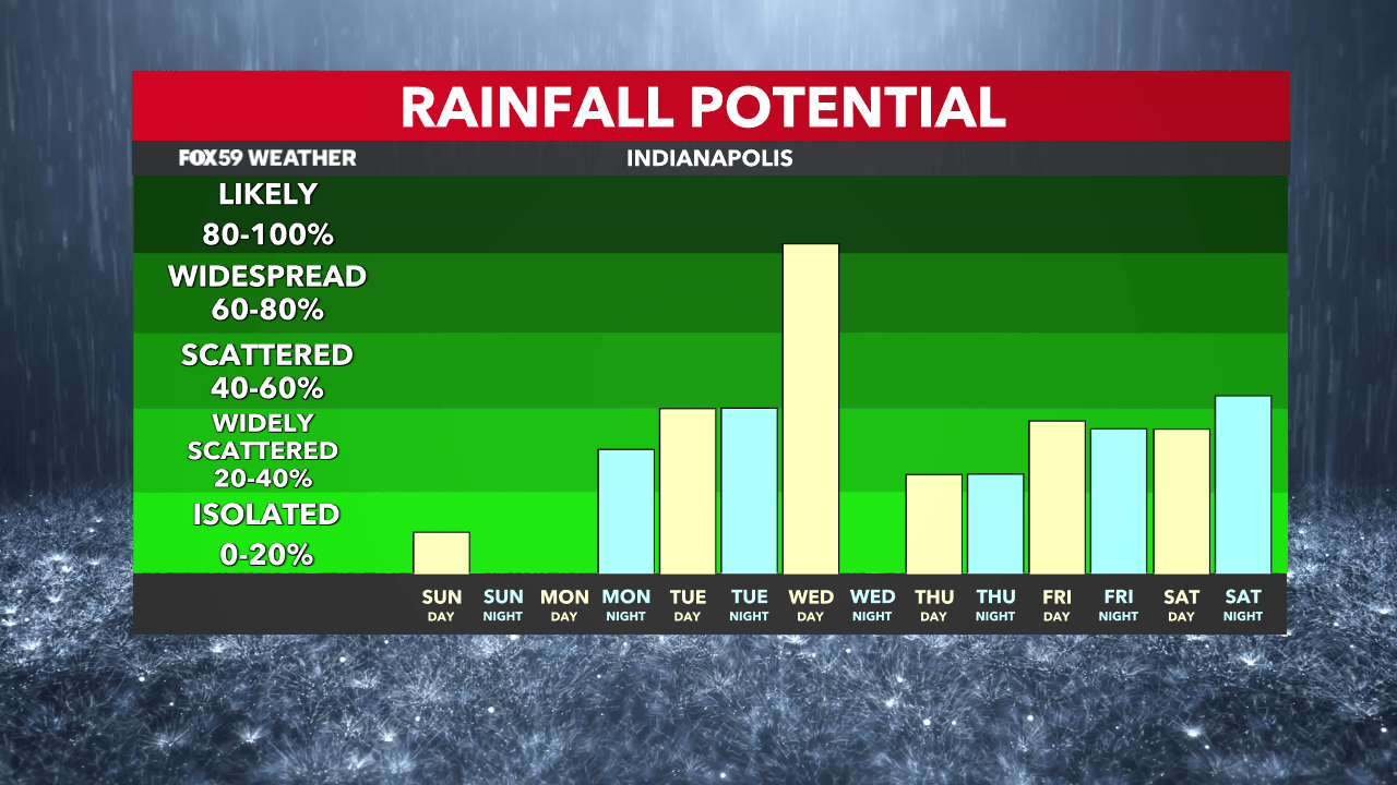
At first, the shower activity is going to be widely scattered, but the coverage will rise by Tuesday night with a storm system moving into the Great Lakes region. A cold front arrives Wednesday, which will allow temperatures to drop back into the lower to mid-70s by the end of the week.
Comments are closed.