
After recording a low of -1° Sunday morning, temperatures started their upward trend for the week. Indianapolis recorded a high temperature of 25° and highs each day going into the week will get warmer each day. However, the workweek will be starting on a messy note with a freezing rain/icing threat for many around here. Then, we turn wet and mild with many spots hitting 50º later this week.
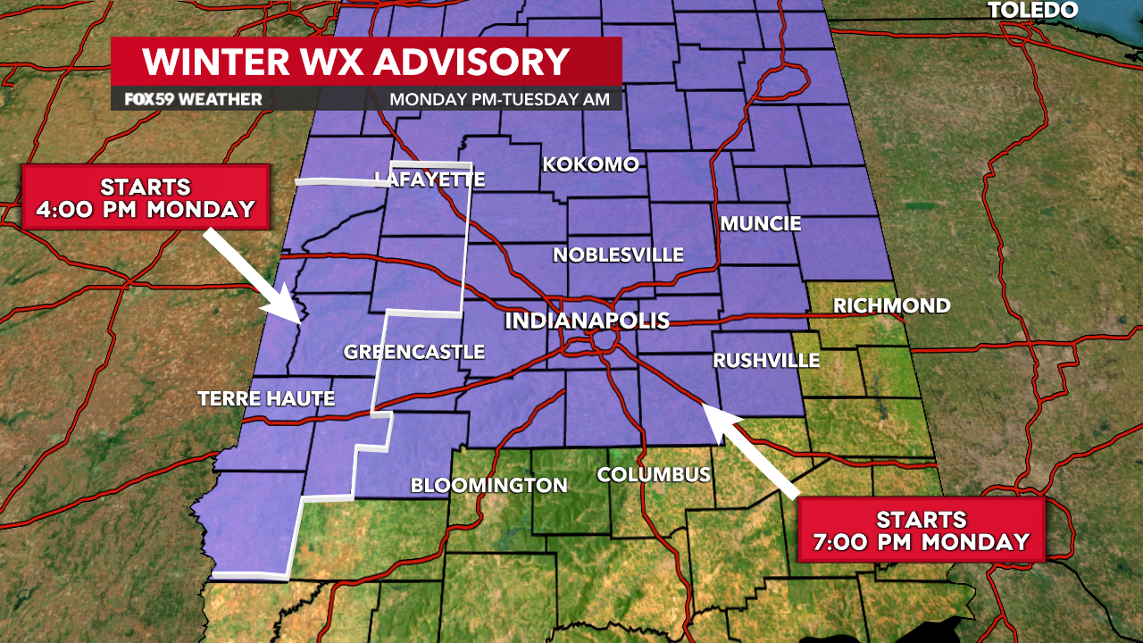
Winter Weather Advisory posted; accumulating freezing rain likely
While Monday will start dry, clouds will move in ahead of a weathermaker bringing a wintry cocktail of rain, sleet, freezing rain, and some snow to parts of the Midwest. High temperatures on Monday will approach the mid-30s before a messy period begins.
A Winter Weather Advisory will be in effect from 7:00 p.m. Monday to 10:00 a.m. Tuesday for most of Central Indiana. Our western counties will be under the advisory starting at 4:00 p.m. Monday. With ground temperatures below freezing, that rain will turn to ice. It will likely create some travel problems late in the Monday PM commute and the Tuesday AM commute.
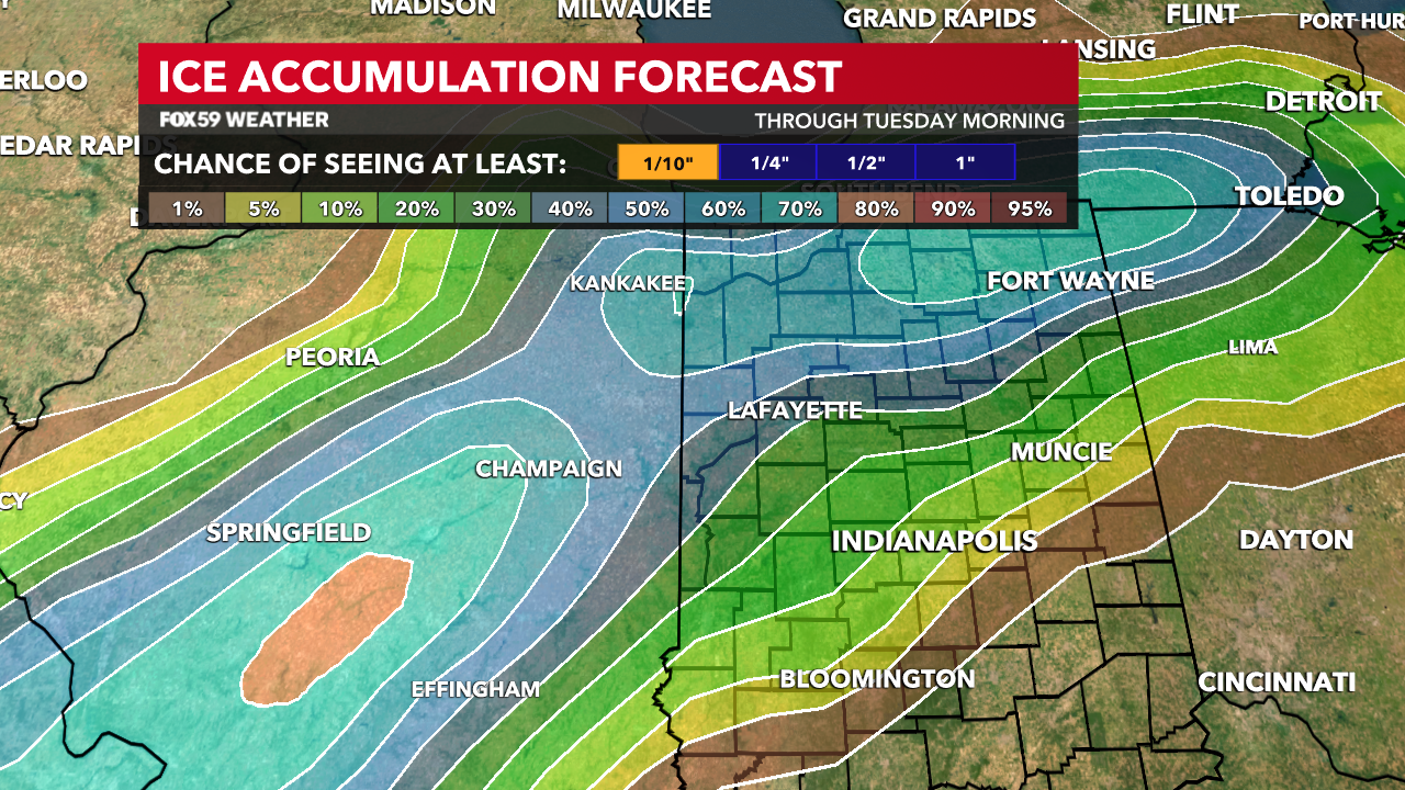
Higher ice amounts around or surpassing 0.10″ are possible along and north of I-70. Areas northwest near Lafayette may see slightly higher amounts. Then, areas south may see up to a light icy glaze. Any untreated roads, sidewalks and other outdoor surfaces will see the biggest impacts.
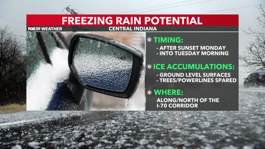
The biggest concerns for icy accumulations will be at the surface rather than surfaces like trees and powerlines. That’s because the the ground temperatures are below freezing while higher, temperatures are warmer. Pay attention to the forecast and be prepared to drive slowly and cautiously from late Monday into Tuesday.
Warm air takes over and turns to rain; wet & mild conditions follow
Temperatures will begin to climb above freezing on Tuesday morning. Once that occurs, that’s when the transition to rain will take place. Continued rainfall through the day will luckily melt any snow and ice on the ground. Highs Tuesday approach 40°.
After Tuesday, temperatures get even warmer with multiple rounds of rain likely on Wednesday and Thursday. Highs will approach 50° on both days. In terms of rainfall potential, I think several spots could approach an inch of rain when all is said and done this week.
Comments are closed.