

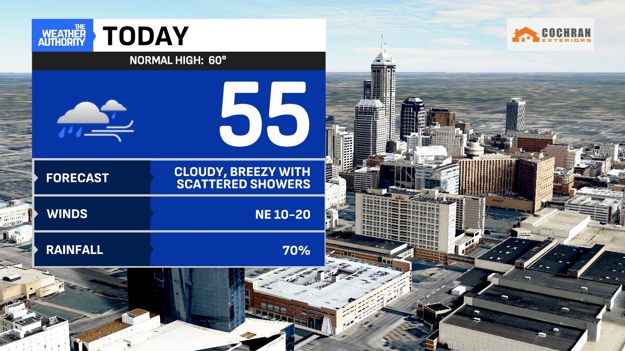
Scattered showers have returned to the area, along with a healthy dose of cloud cover. This morning will be a bit unsettled, especially for downtown and/or points south, where the steadiest of the showers have set-up.
Winds are not too breezy but are expected to pick up through the day. Out-the-door temperatures will hover in the lower 50s and upper 40s for the morning rush.
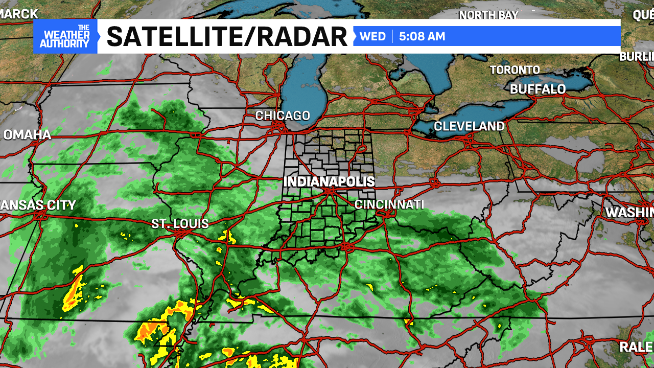
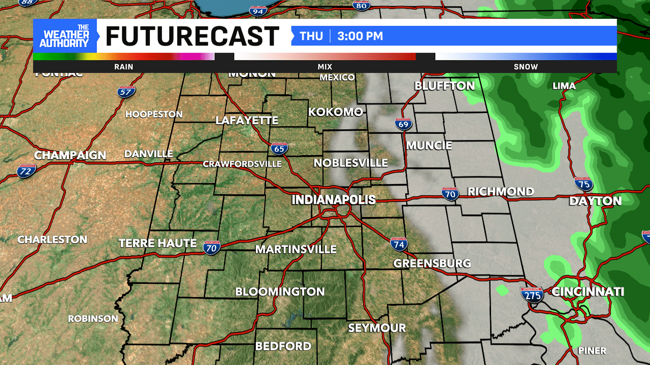
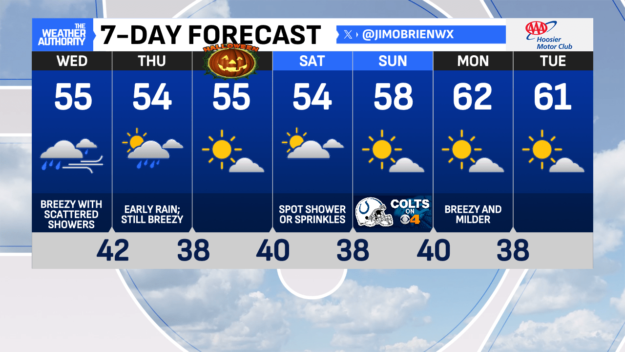
Today will remain quite overcast with off and on showers. As mentioned, our northern counties will not receive much rainfall, while our southern counties will likely remain unsettled with the steadiest rain chances as totals mount up. We are just on the northern flank of a much larger storm system drifting through the Tennessee Valley.
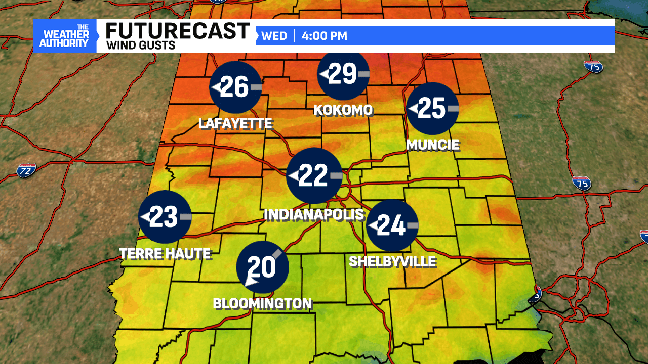
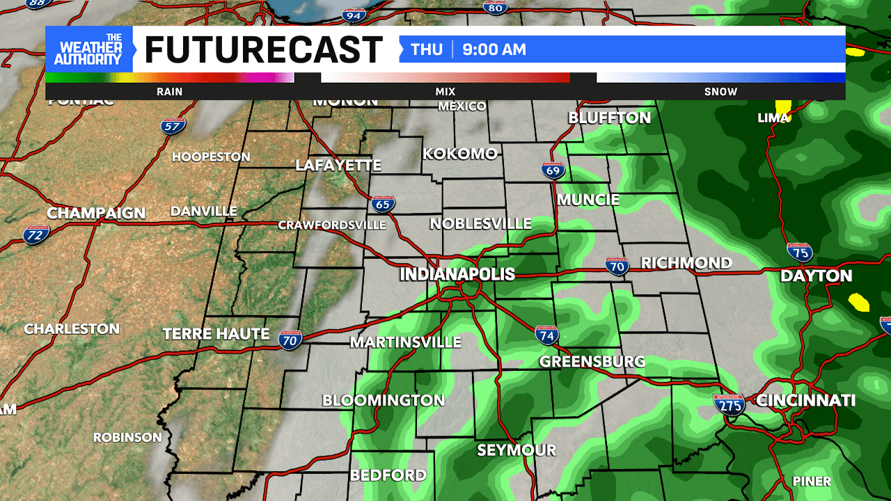
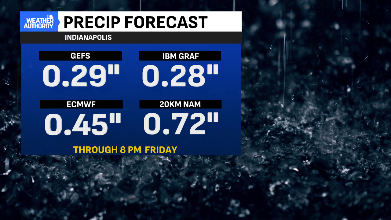
Expect winds to increase this afternoon, with gusts up to 30 mph, as the storm complex deepens and passes through our region. It appears the steadiest rainfall will arrive this evening for Indianapolis and take us into early Thursday morning.
Thursday will be wet for nearly half of our viewing area, while winds remain breezy under heavy clouds in the morning. By the afternoon, clouds will depart from west to east, along with the rain, while winds remain breezy until the evening. Another cool day is expected.
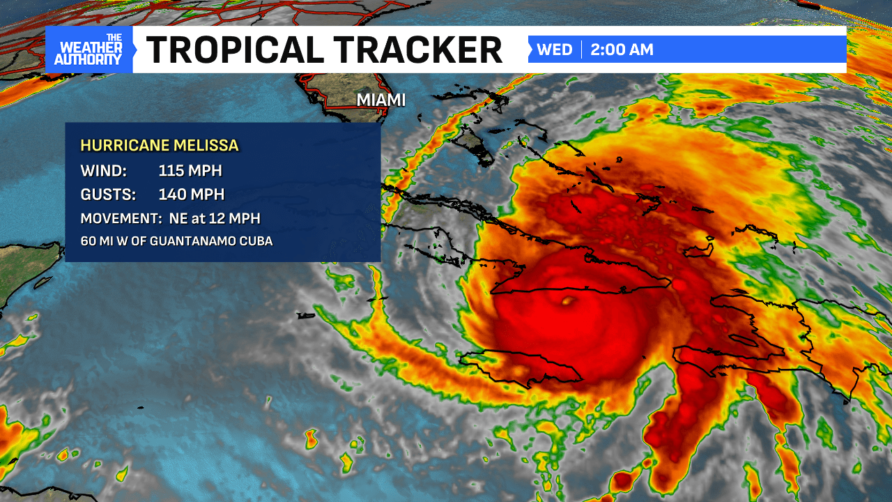
Hurricane Melissa just made landfall in eastern Cuba at 3:10 a.m. as a Category 3. The devastation in Jamaica is still somewhat unknown but a more clear picture will come into focus in the days ahead and recovery could take years.
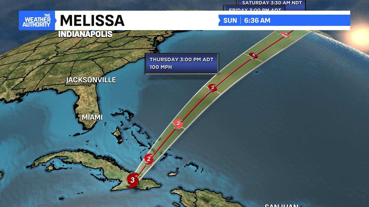
Movement from Melissa has picked up, while winds have weakened and should be nearing the Bahamas later today into tonight before moving back into open water and staying well away from the United States.
As for the weekend ahead here locally, expect plenty of dry time for Halloween evening and only a few spot showers statewide on Saturday.
Comments are closed.