

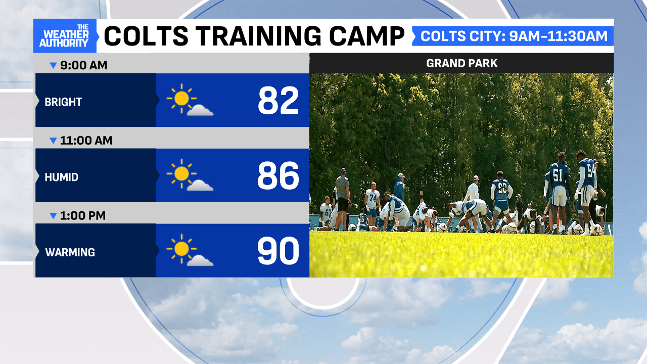
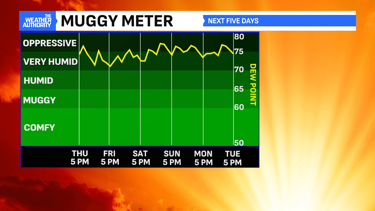
Skies are mostly clear and temperatures much warmer to begin your Thursday morning, as muggier air (higher dew points) has returned to the state. Dry conditions remain out-the-door and the morning rush hour should be a fairly quiet one.
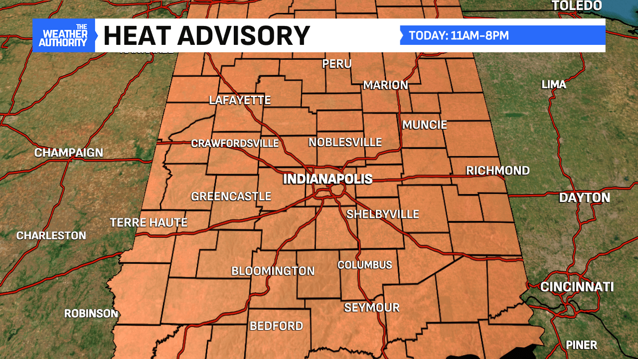
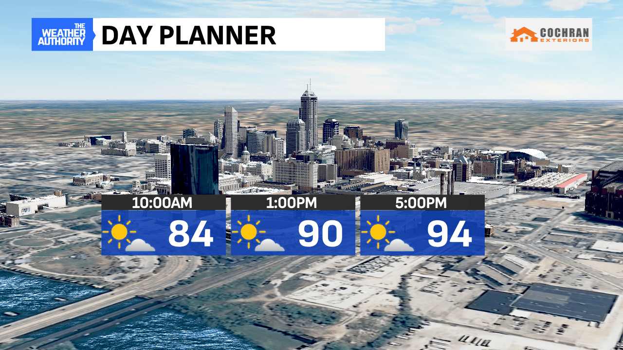
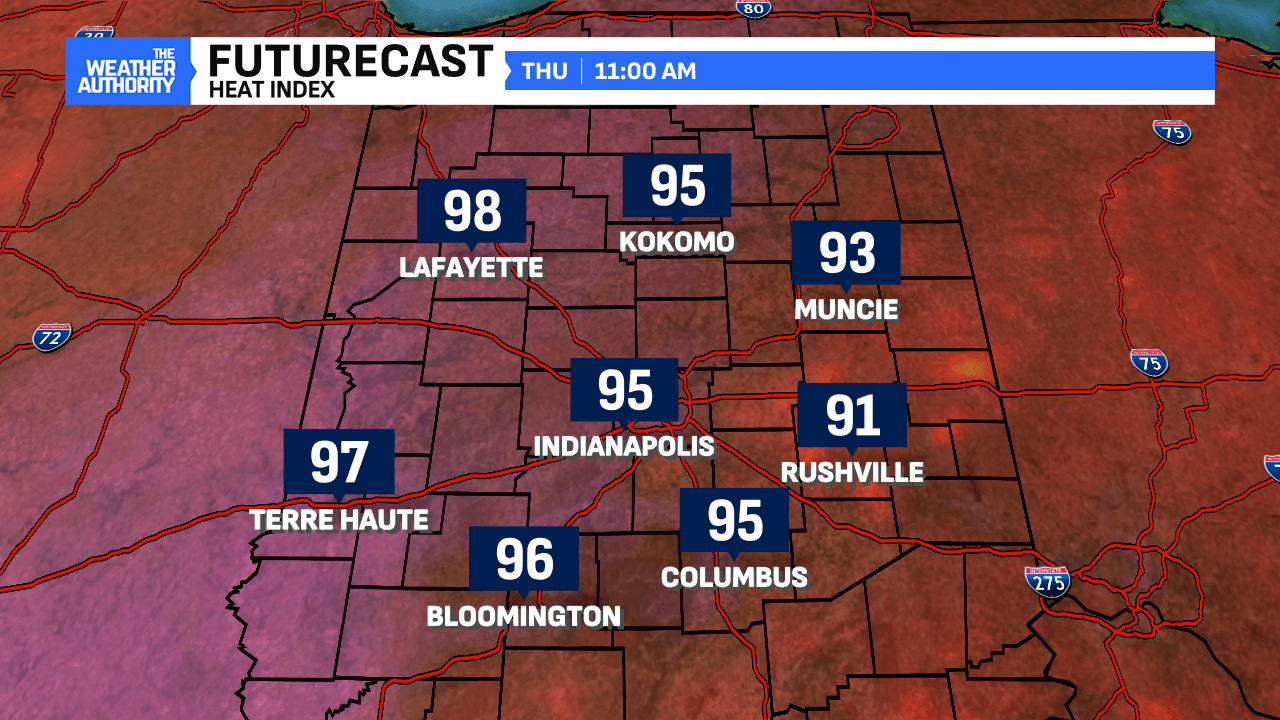
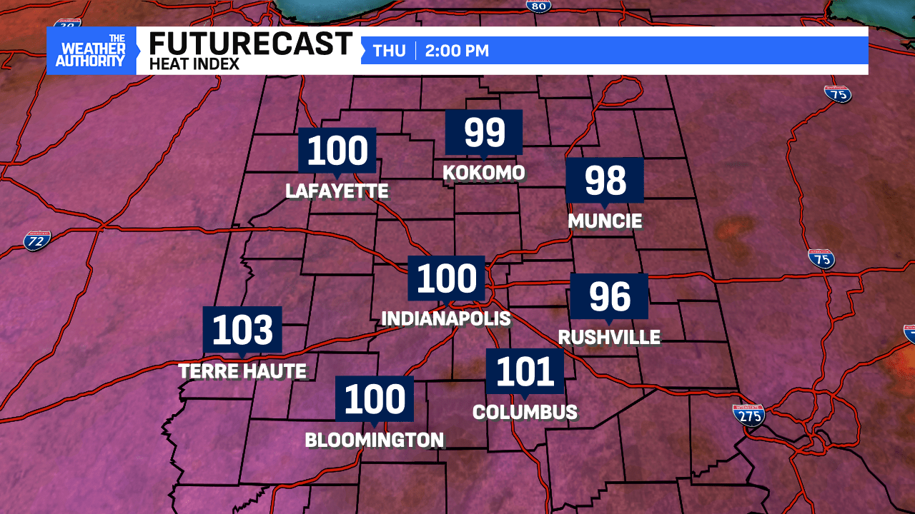
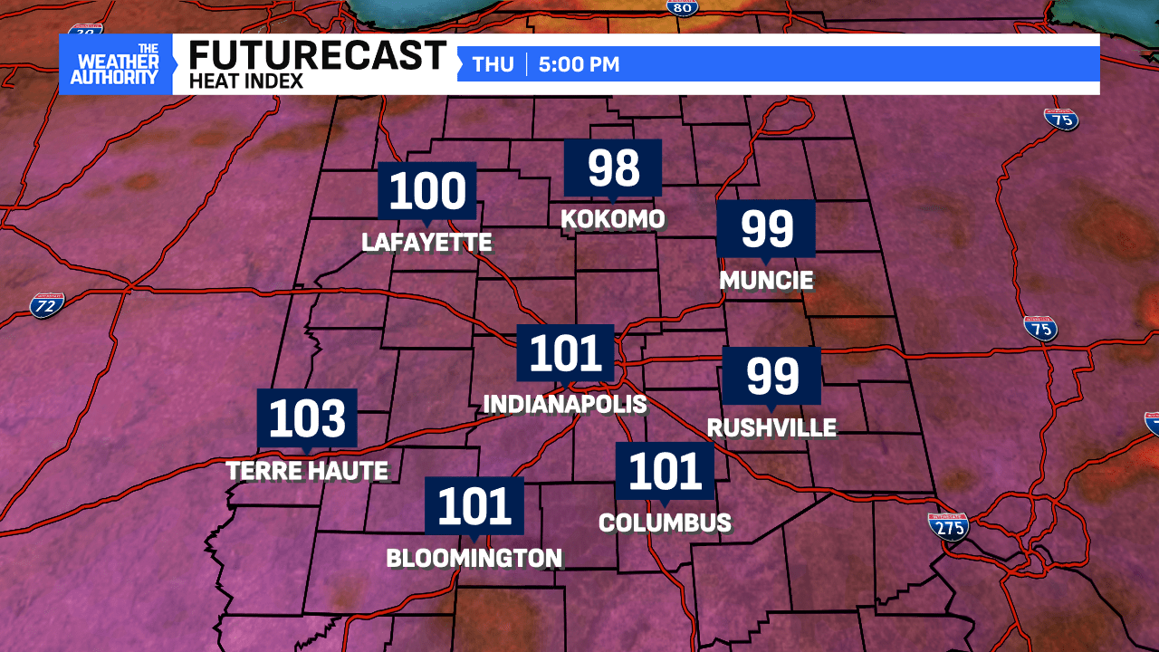
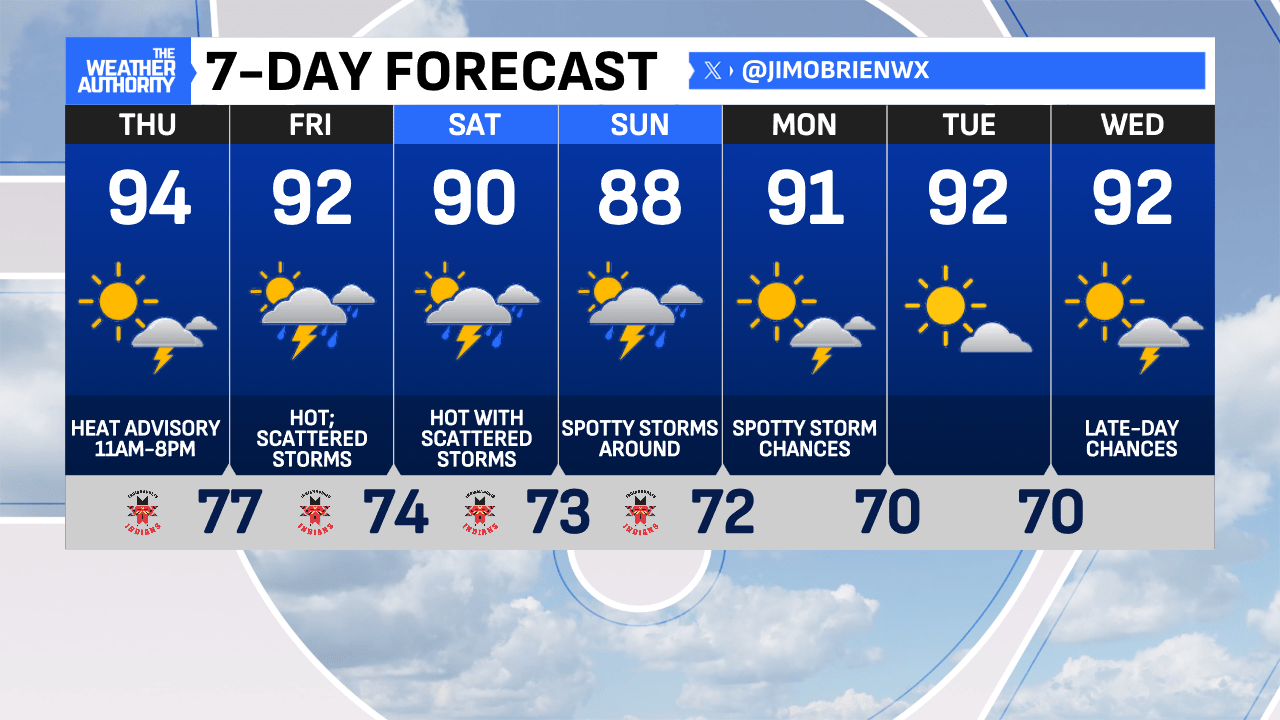
Intense heat begins late morning, under nearly full sunshine. The Heat Advisory goes into effect at 11 a.m. A quick rise in temperatures, along with the more humid air, will make for a very uncomfortable day and could turn dangerous, if not taken seriously while working outdoors! Have water on hand and take numerous breaks in the shade.
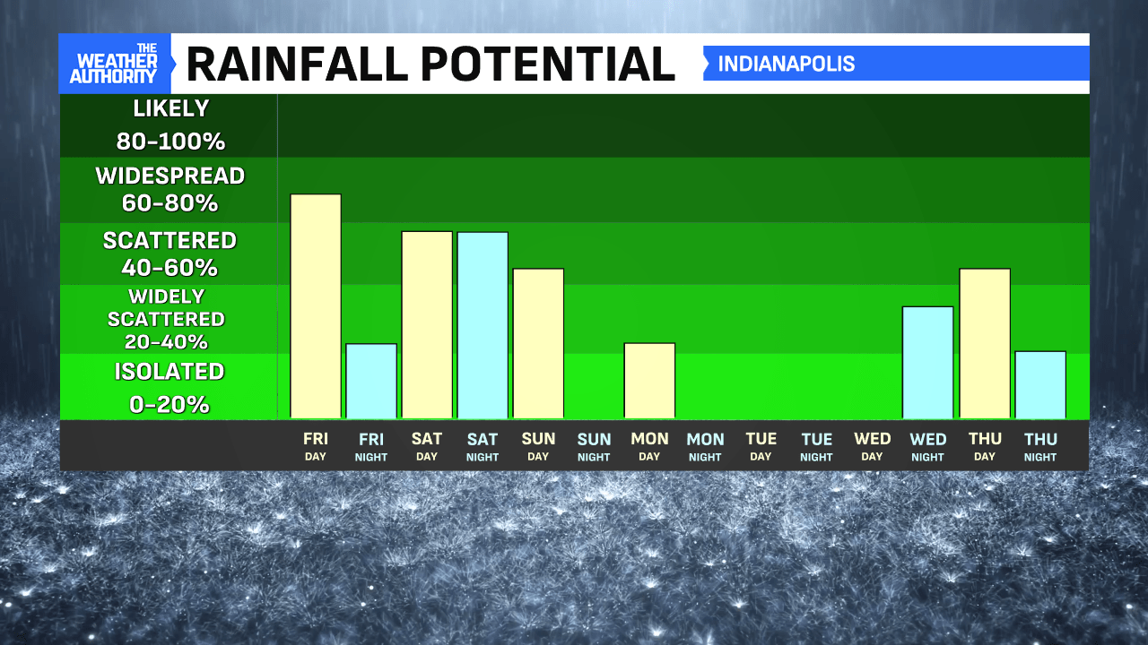
Our forecast high could reach 94°, marking the hottest day of the year but nowhere near the record high of 105° back in 1934. A small shower/storm chance could flare up late afternoon (10%) in the southeastern part of the state.
More heat and humidity are expected on Friday and for the weekend, as 90s hang around but storm chances increase in coverage daily. This will bring some relief at times but the tropical air will linger.
Comments are closed.