
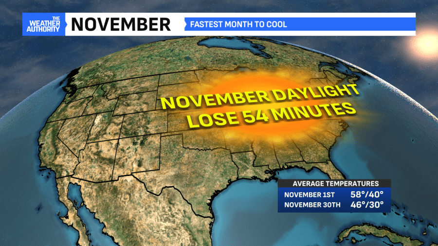
Welcome to November! It’s our fastest cooling month annually in central Indiana and a month where we continue losing daylight. Our normal high of 58° now drops to 46° by the end of the month. Additionally, a given November sees 0.8″ of snow on average. We aren’t talking about any snow in our near future at all. In fact, we’re talking about the opposite given the milder air moving in next week.
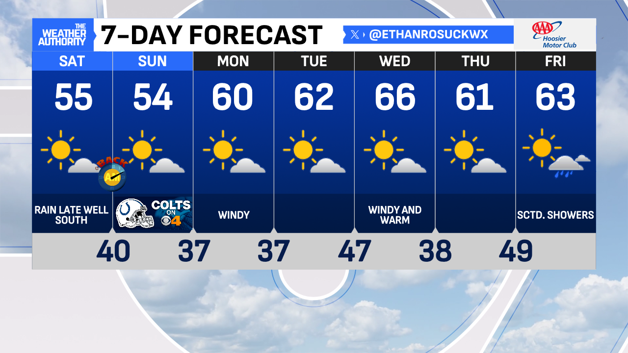
Expect seasobably cooler temperatures both Saturday and Sunday. Forecast highs in the mid-to-low 50s are a few degrees below average. We will remain dry, for the most part, minus a rain chance very late Saturday.
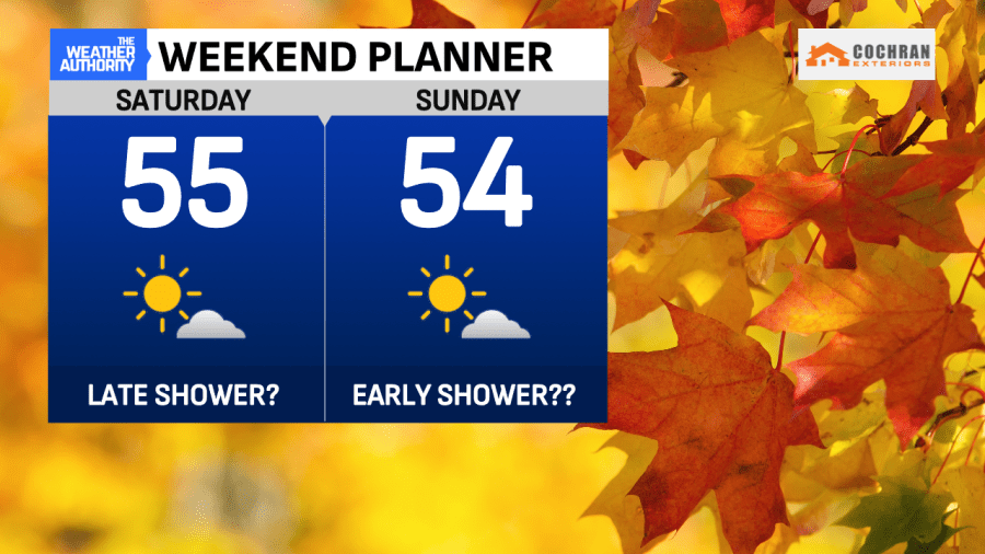
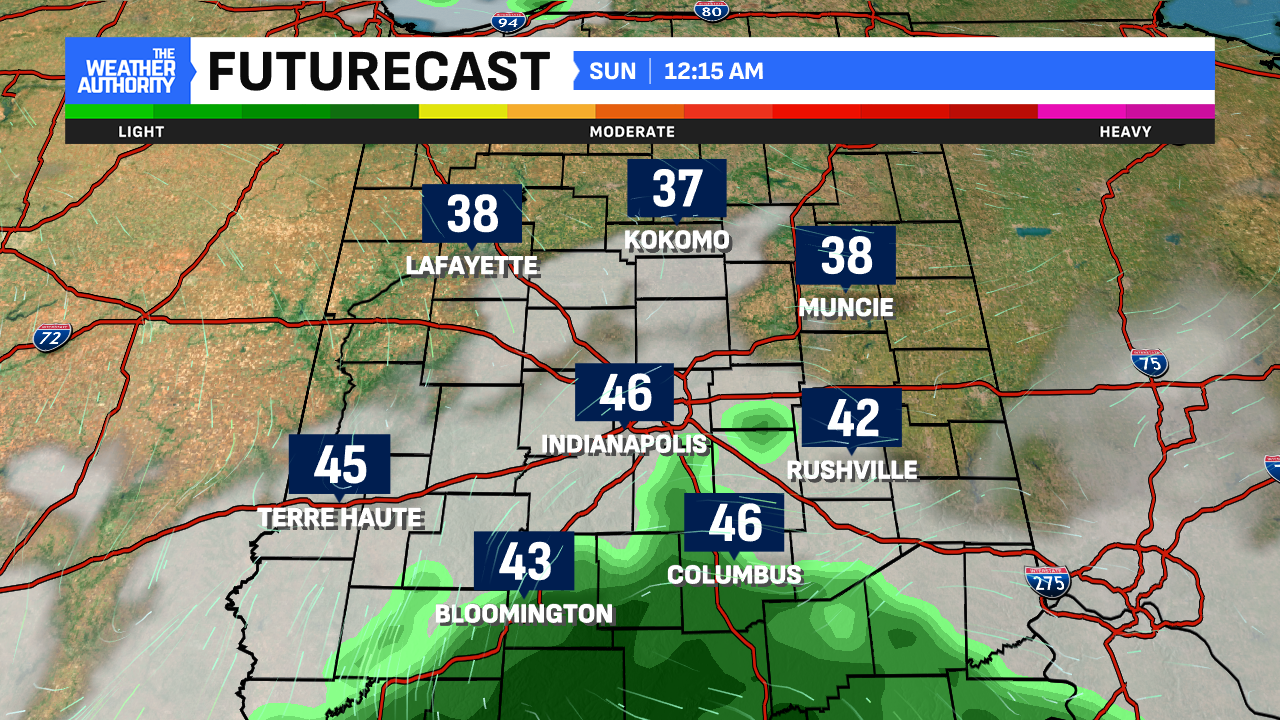
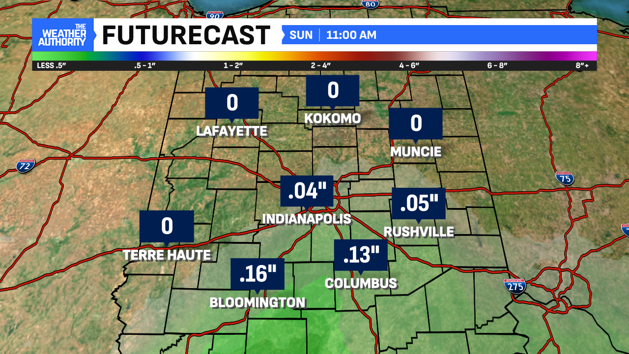
A weak system today passes just to our south. Most of us will stay dry. But keep an eye out if you’re in our counties south of I-70. It’s those spots where the most persistent, light rain showers look to be. Timing on this will be late tonight and into very early Sunday. Amounts look to be light, generally under a quarter of an inch.
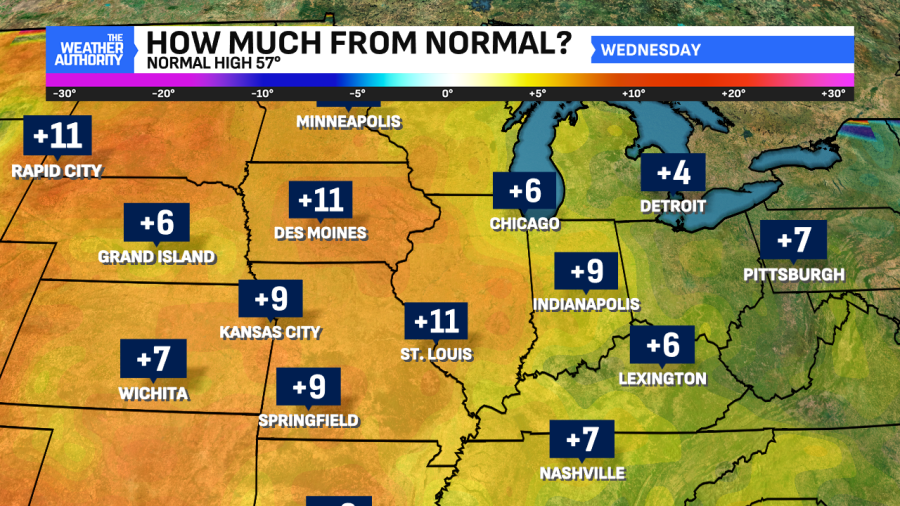
The first full week of November looks dry. It’ll also be a week filled with mainly sunny skies, breezy conditions and a gradual mild trend. By Wednesday, central Indiana will feel more like October with highs in the mid-to-upper 60s. Those are numbers nearly ten degrees above normal for this time of the year!
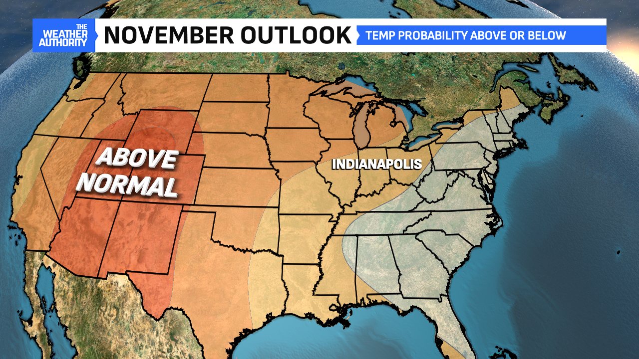
For the month as a whole, November 2025 does look to trend above normal even though it is our fastest cooling month annually. After tonight’s rain chance, no rain is forecast until at least next Friday.
Comments are closed.