
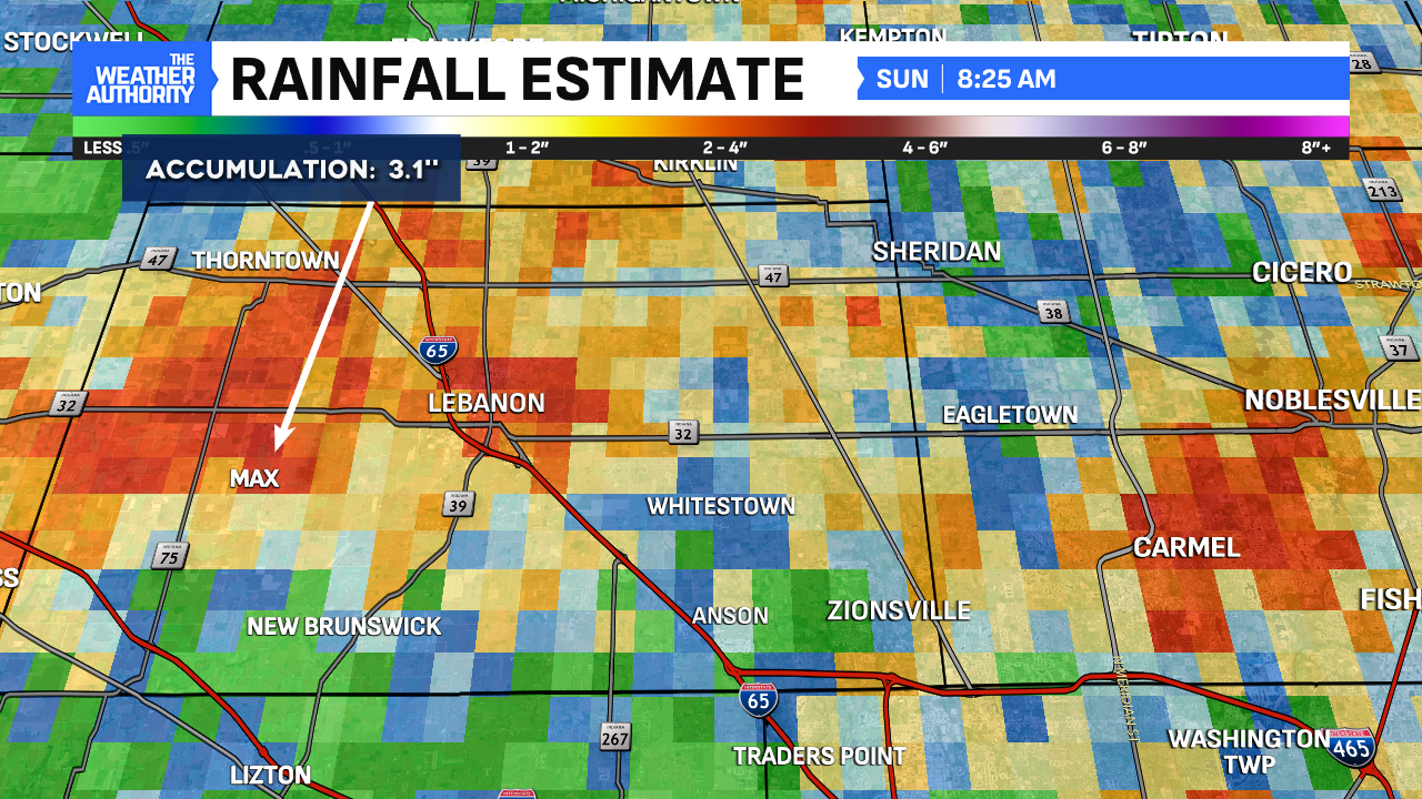
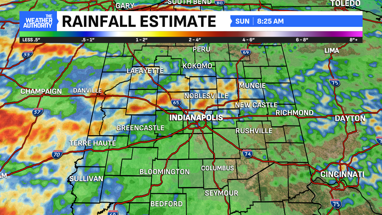
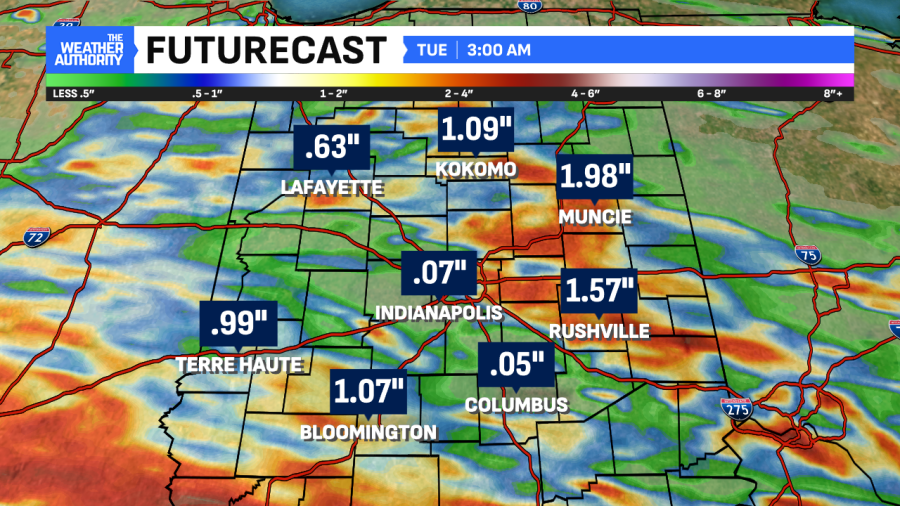
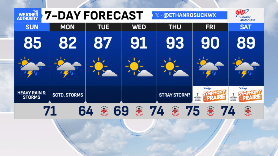
After a few hometowns north of Indianapolis received 1-3″ of quick rains, more of this on a widespread basis is on tap today. We’re monitoring showers moving into the region Sunday, spawning a Severe T-Storm Warning for Tippecanoe County in the process. The rain will stay with us through Sunday and Monday. Grab the umbrellas!
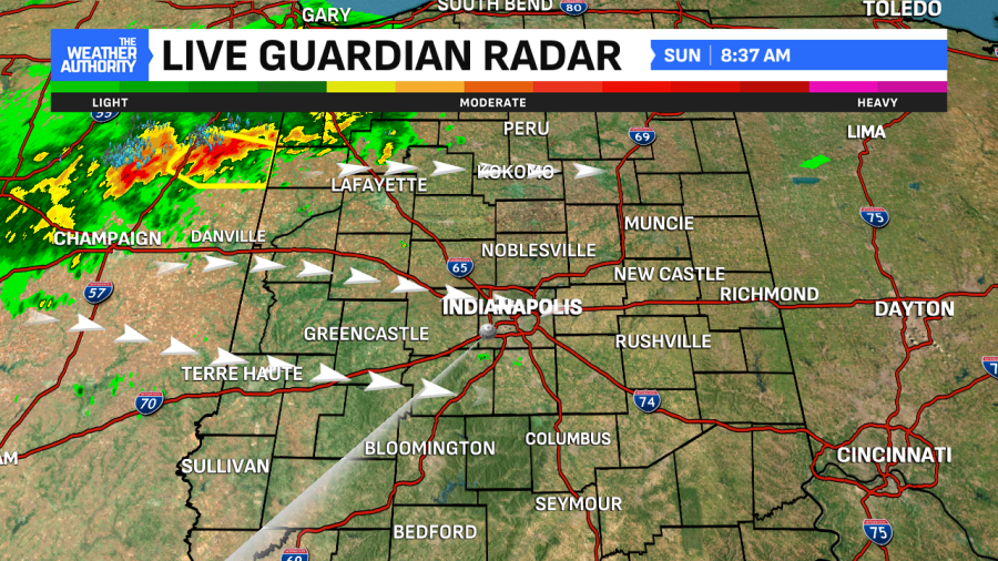
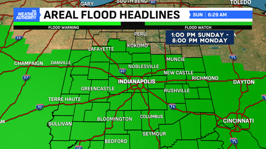
Flood WATCH kicks in Sunday at 1:00 PM. Numerous showers and isolated storms will be around late morning and continue through the day. Downpours and flash flooding are the biggest threats along with an isolated damaging wind threat. Some stronger storms are possible. Remember, turn around, don’t drown!
Additionally, more rain is expected going into the work week on Monday. With the added moisture in the atmosphere, it’ll continue fueling the showers for heavy rain at times. When all is said and done, more spots could see 1-3″ of rain and localized flooding through Monday. The moisture present will keep things humid until late Monday.
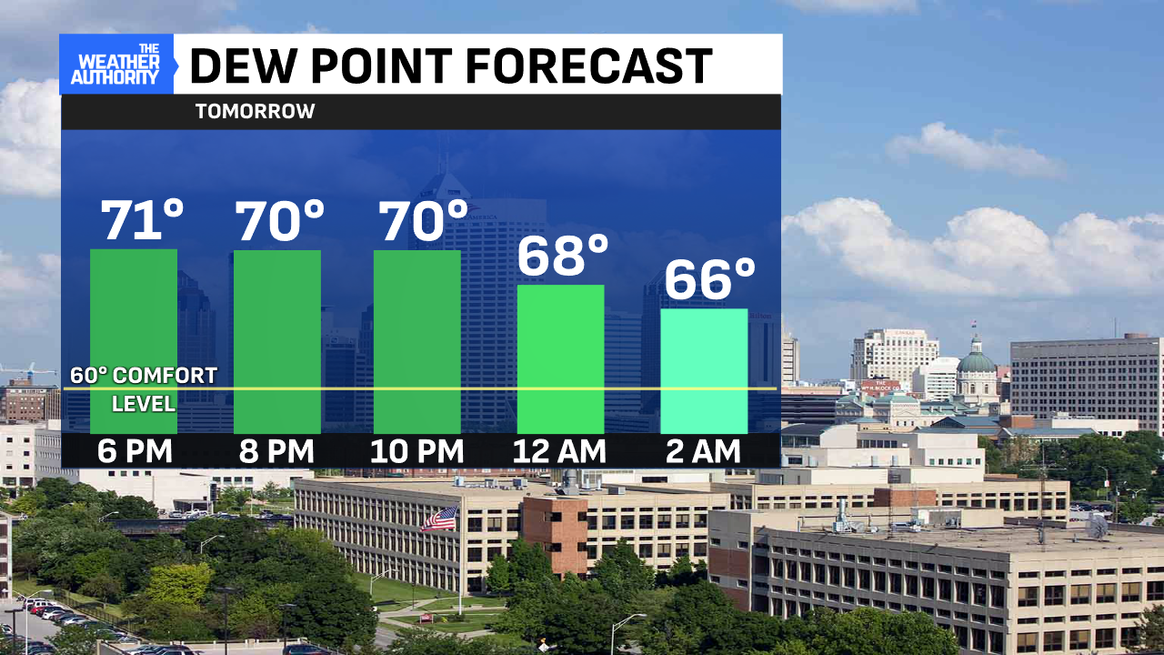
Humid conditions linger until late Monday. See the graph below on when dew points will start dropping. It’ll be nice and well-deserved relief across central Indiana. However, the lower dew points will only be a thing briefly through Tuesday.
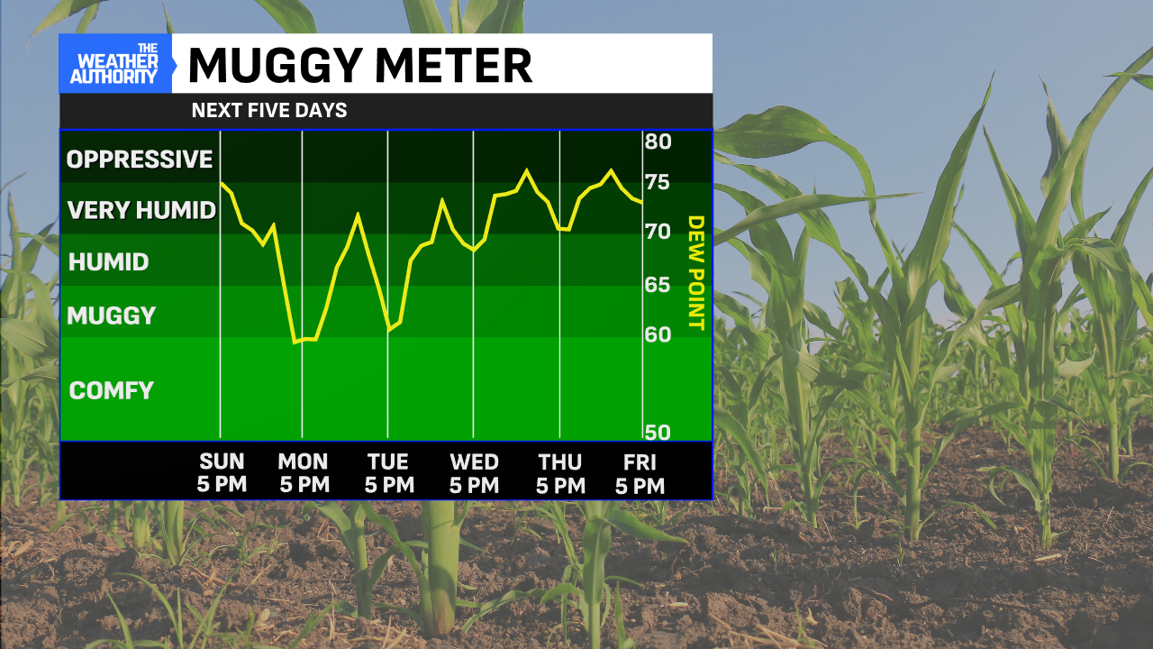
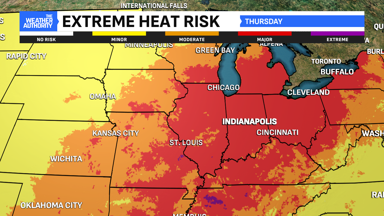
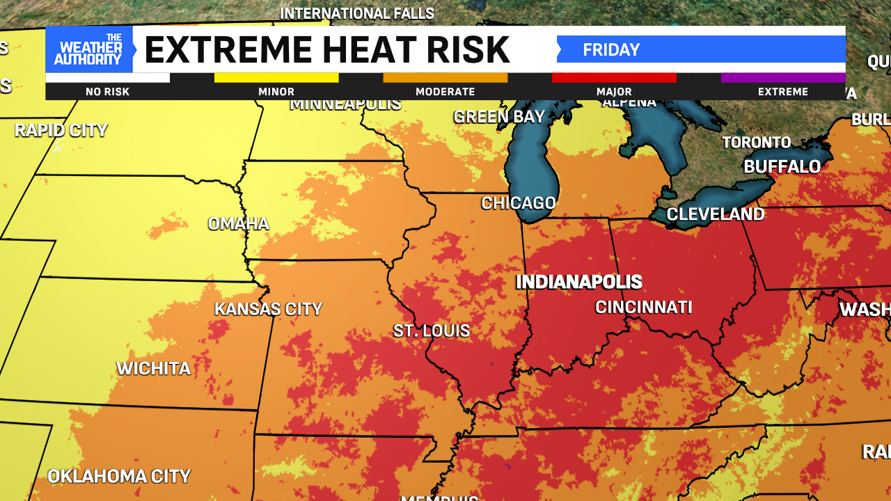
Taking a look at the Muggy Meter, dew points will skyrocket once again starting late Tuesday and peaks Wednesday-Friday. Thanks to the added moisture from the Gulf and the corn, we could see dew points approach 80° during this timeframe. That means heat indices above 100° are likely for several days. That’ll be important to monitor and stay safe during the heat wave!
Comments are closed.