
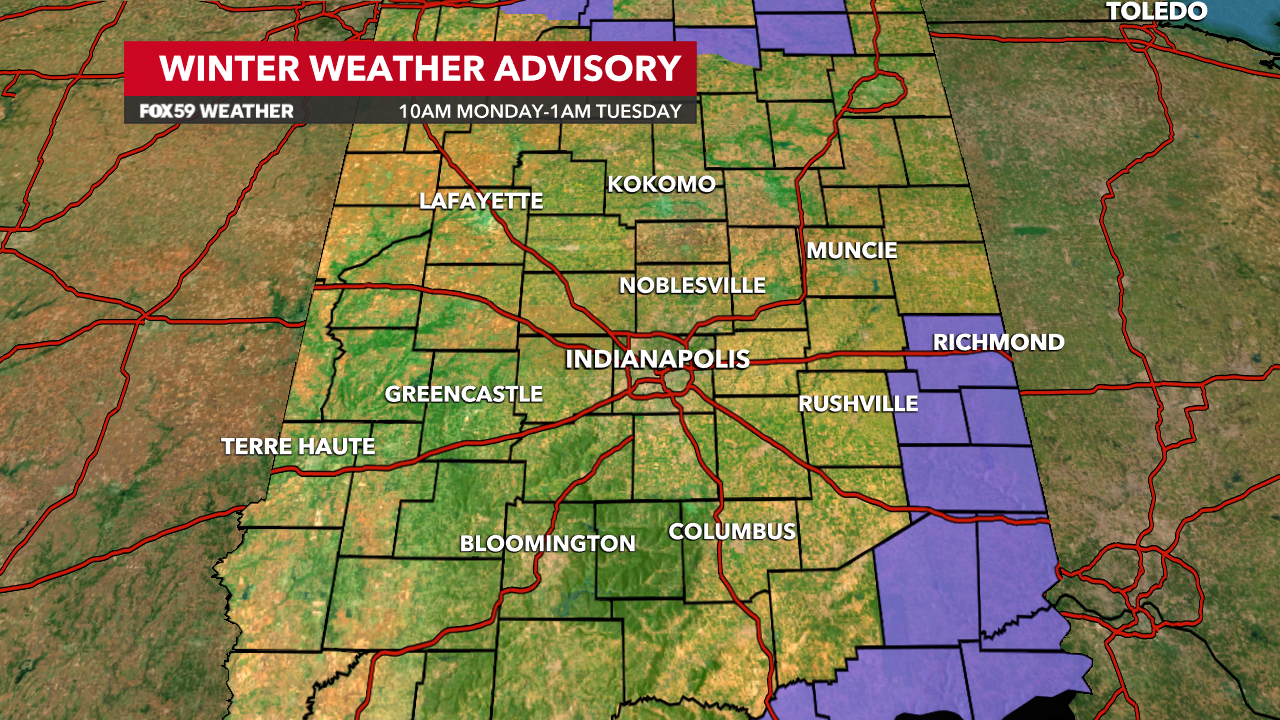
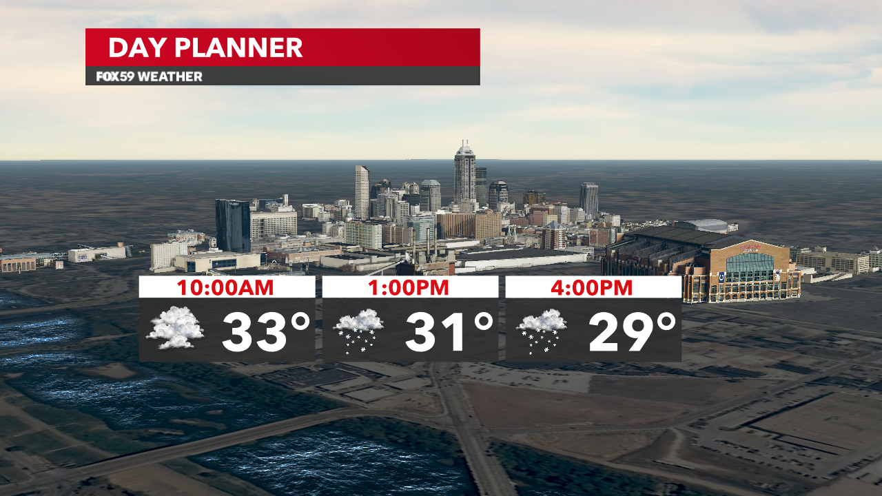
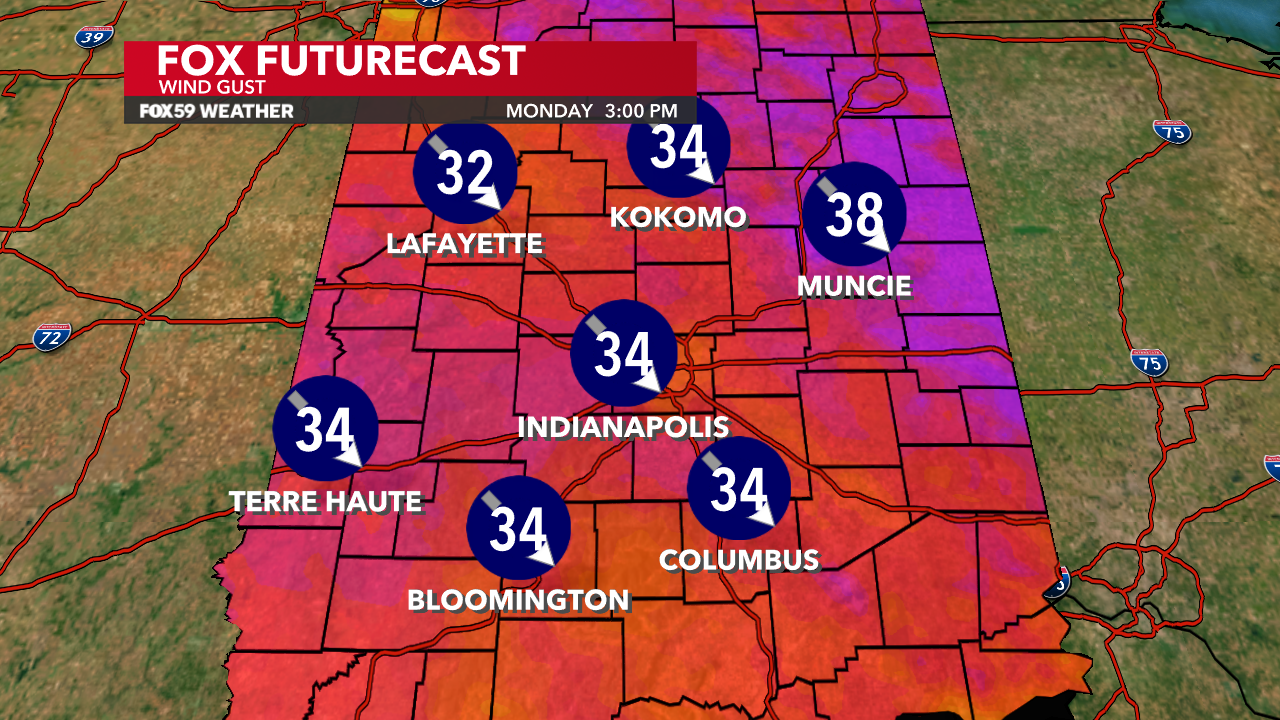
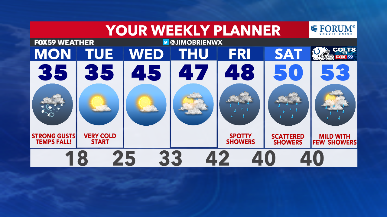
We are awaiting the passage of a cold front this morning–a front that will bring sharply colder changes today, strong wind gusts and falling temperatures. Winds will turn blustery from the northwest at 20-40 mph, while temperatures begin to fall into the upper 20s by 4 p.m.
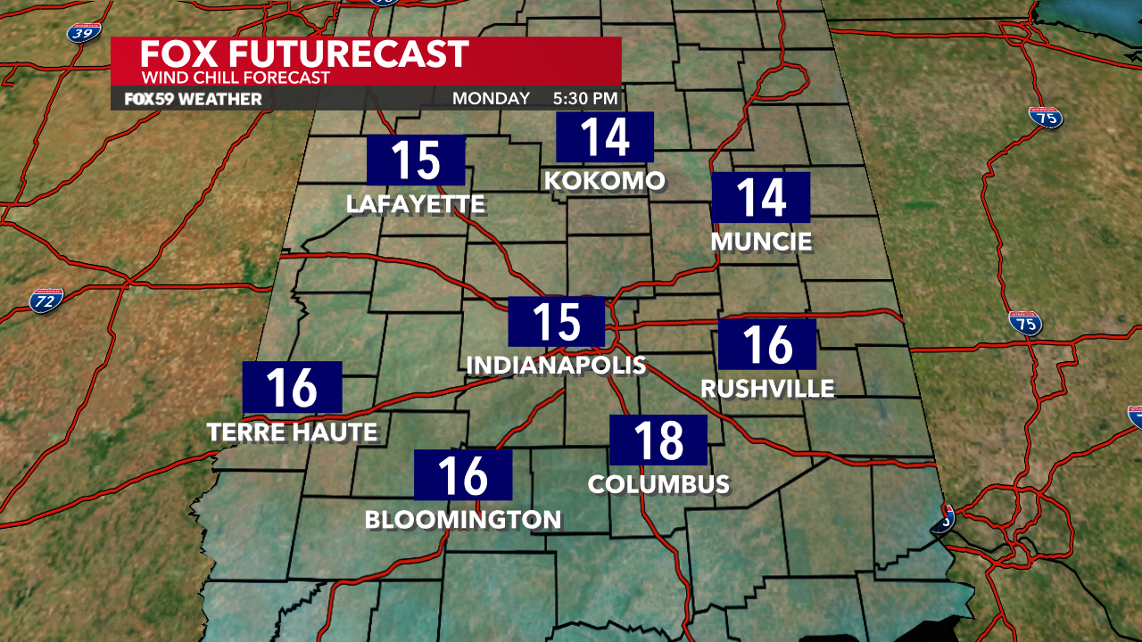
This will generate wind chills in the teens, as flurries and snow showers get going in the colder air and northwesterly flow. It appears that any accumulations will remain light locally with some areas in northeastern and eastern Indiana receiving up to 2″ but only in very localized areas closer to the Ohio state border.
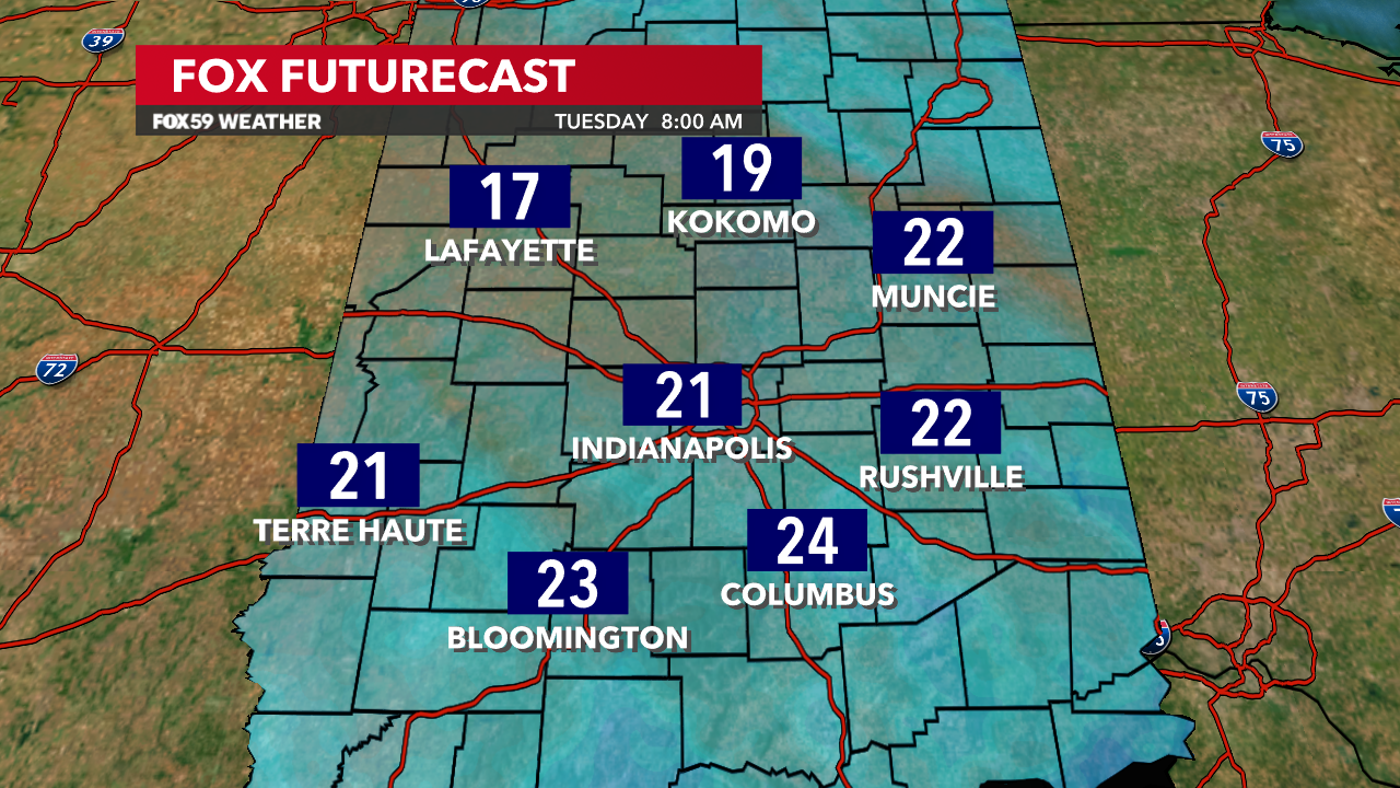
Tonight, flurries will continue under colder air and slowly clearing skies. The winds will relax and lows will drop into the upper teens by sunrise.
Tuesday and Wednesday bring a return to sunshine and a slow warming trend! Rain showers return by Friday and into the holiday weekend, as temperatures move into the 50s for afternoon highs. A white Christmas will not happen this year; it appears the temperatures will be too warm!
Comments are closed.