
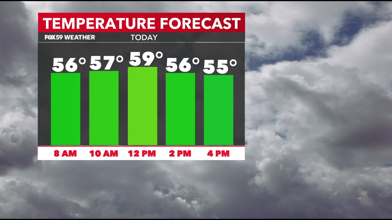
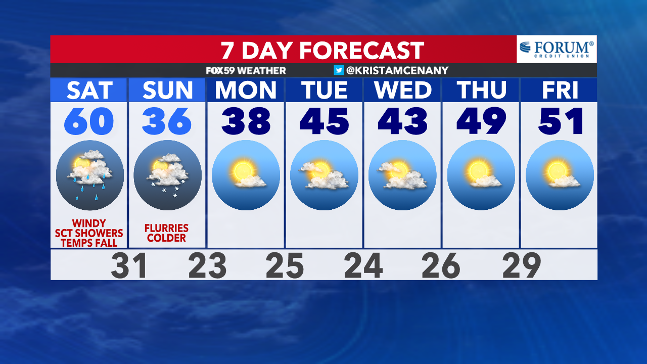
What a start to the weekend! We are starting this Saturday morning are with temperatures in the upper 50s to 60°. These temperatures are more typically for high temperatures in late October and early November. The average high temperature for Indianapolis on this date is only 42°. We’re starting the morning well above that and will see the thermometer climb a couple more degrees through the morning. We peak near 60° across central Indiana near noon, then temperatures will start to slowly fall into the afternoon.
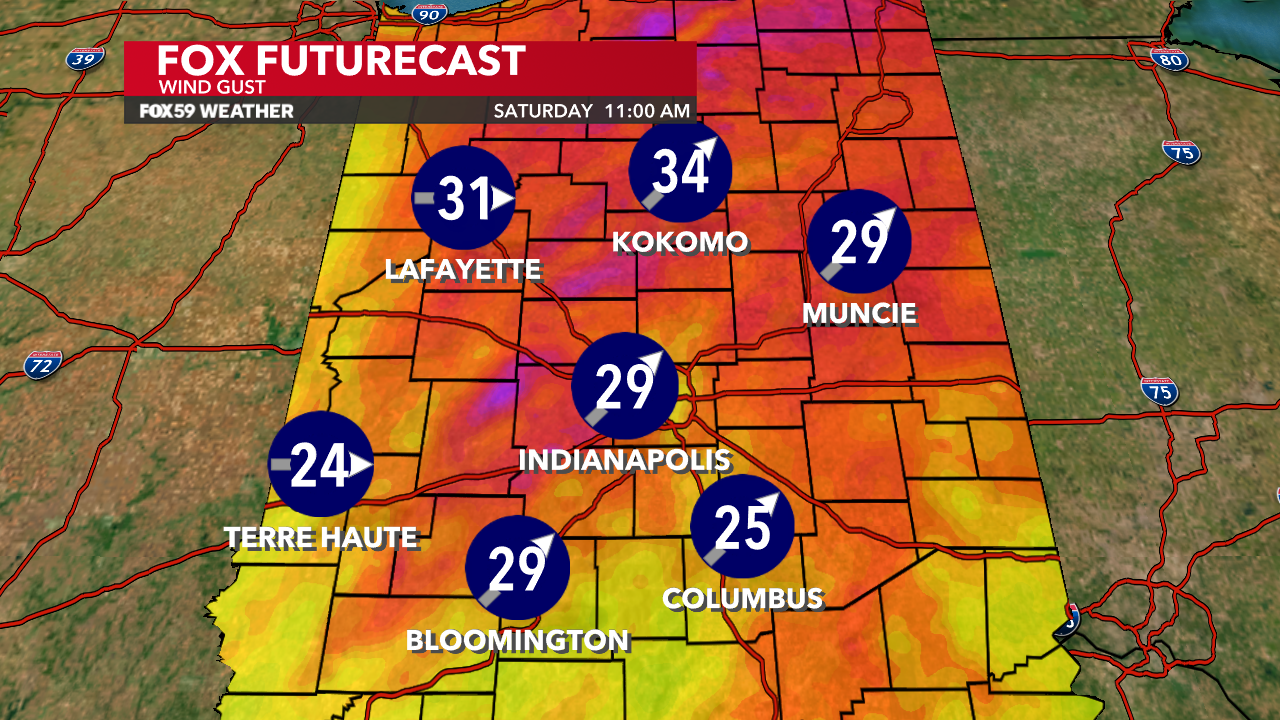
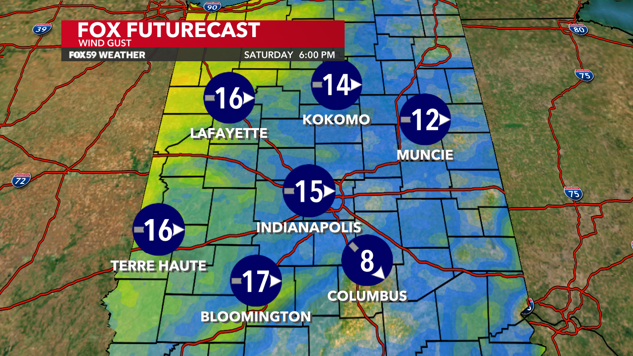
Gusty winds continue Saturday with gusts up to 30 mph possible. Winds will shift out of the west this afternoon and will ease in intensity but will remain rather breezy on through the rest of the weekend.
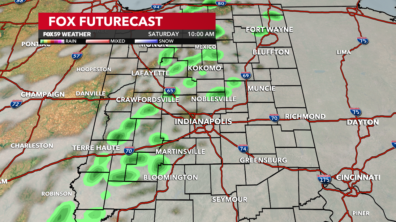
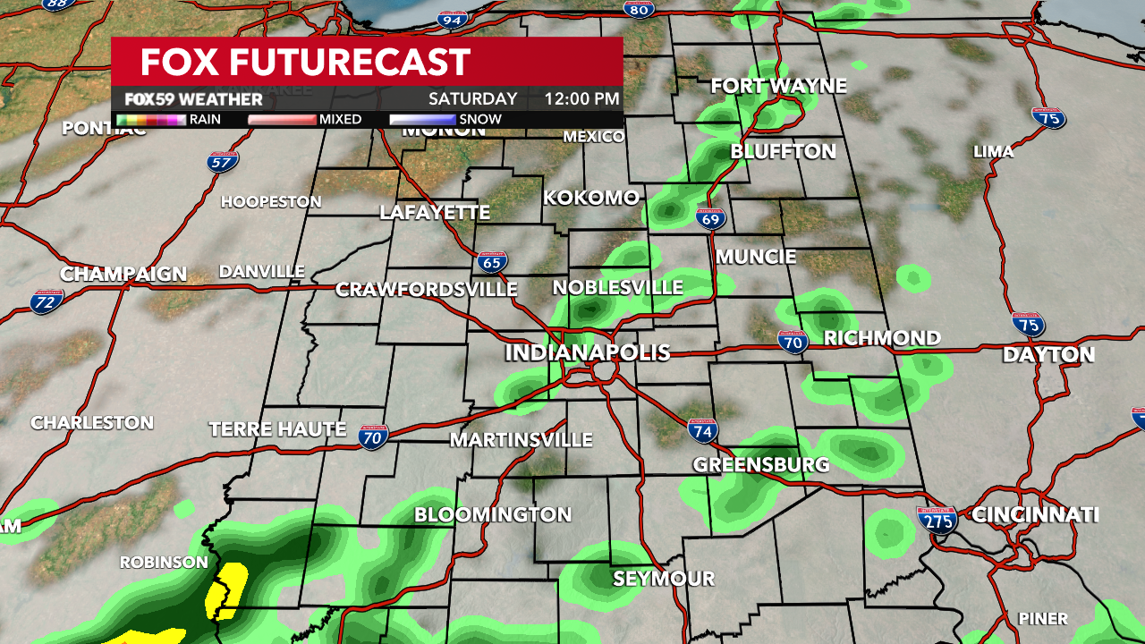
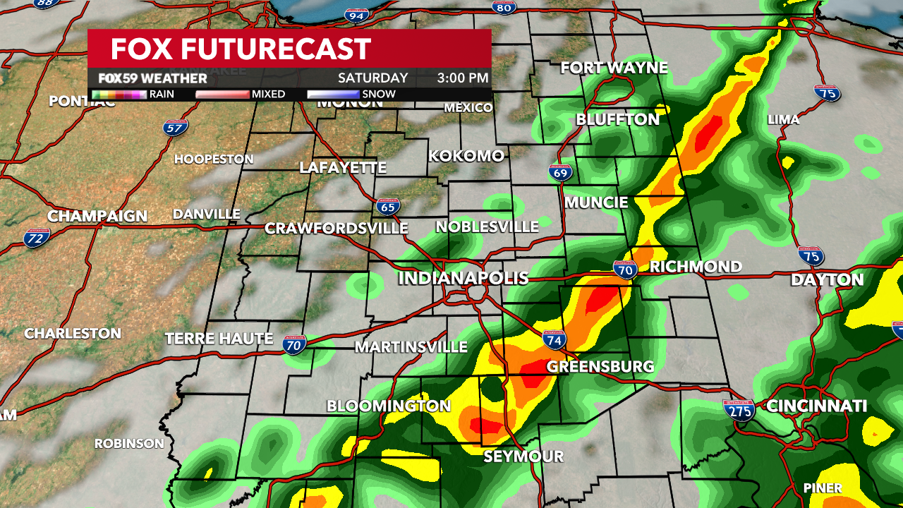
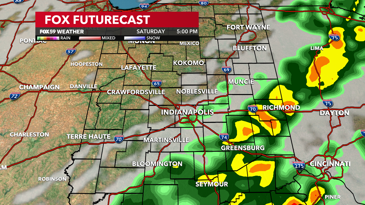
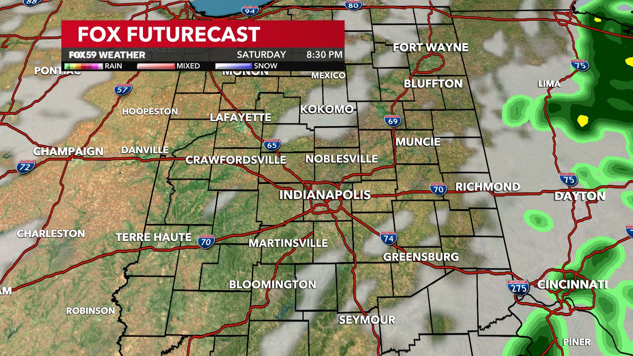
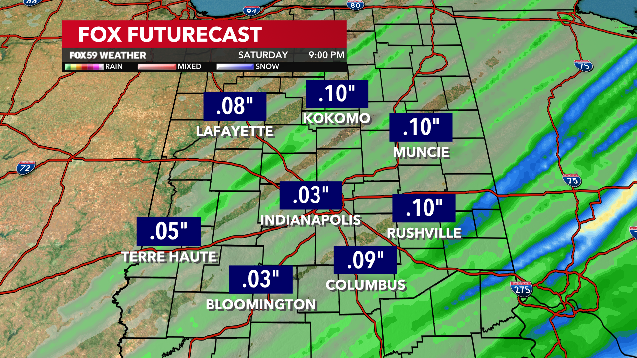
Spotty to widely scattered showers will be around throughout Saturday with our heaviest rainfall coming in the late afternoon and early evening hours. A cold front passing this afternoon will squeeze out all available moisture we have in the atmosphere and bring more moderate to heavy showers to some locations in central Indiana. This will be more favorable in our eastern and southeastern counties. By the evening, it is these locations where our rainfall will be concentrated, while the rest of central Indiana is drying out.
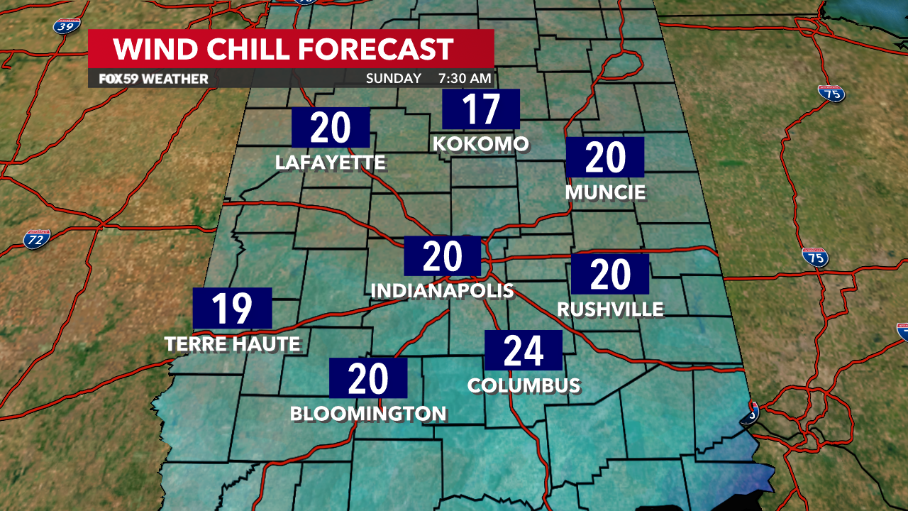
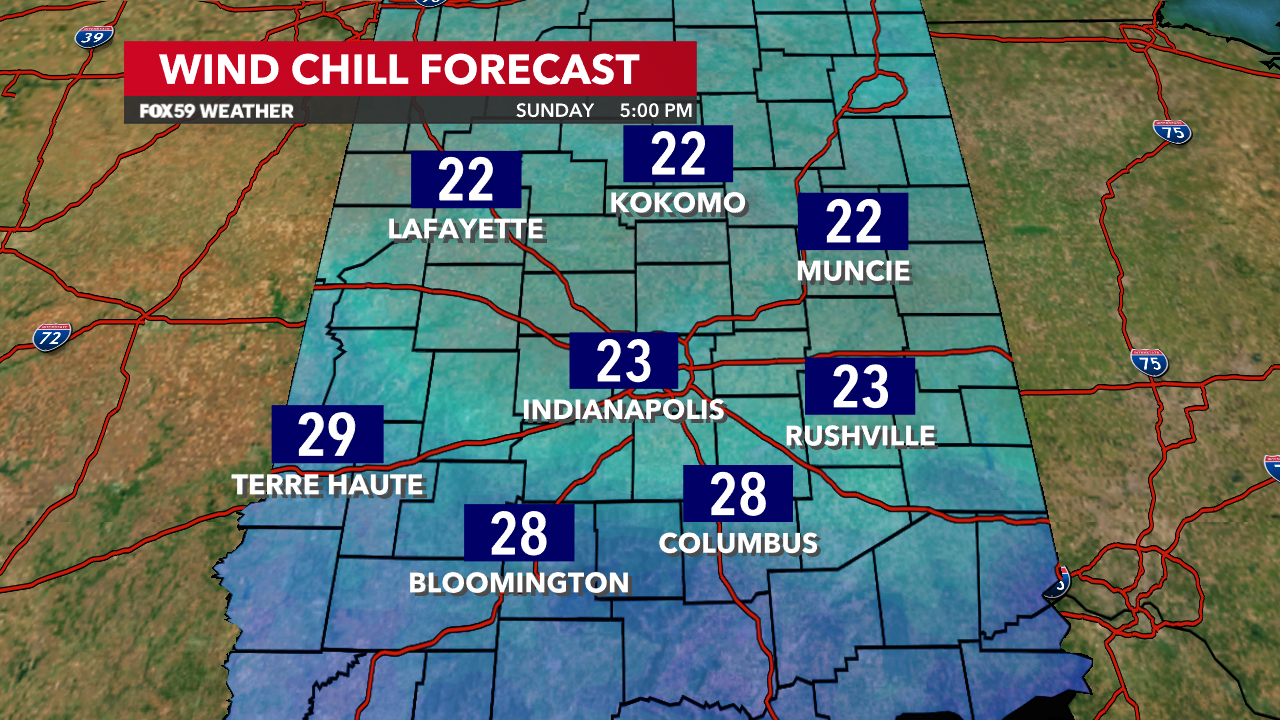
The thermometer plummets to the upper 20s and lower 30s early Sunday morning. Wind chills tomorrow morning will be in the low 20s with breezy northwest winds. Sunday will be a blustery day with afternoon temperatures only rebounding to the mid 30s and wind chill values remaining in the 20s. We finish the weekend with mostly cloudy conditions and the chance for a few flurries Sunday morning through the afternoon. This shot of cold air is brief. A new warmup gets right to work for next week.
Comments are closed.