
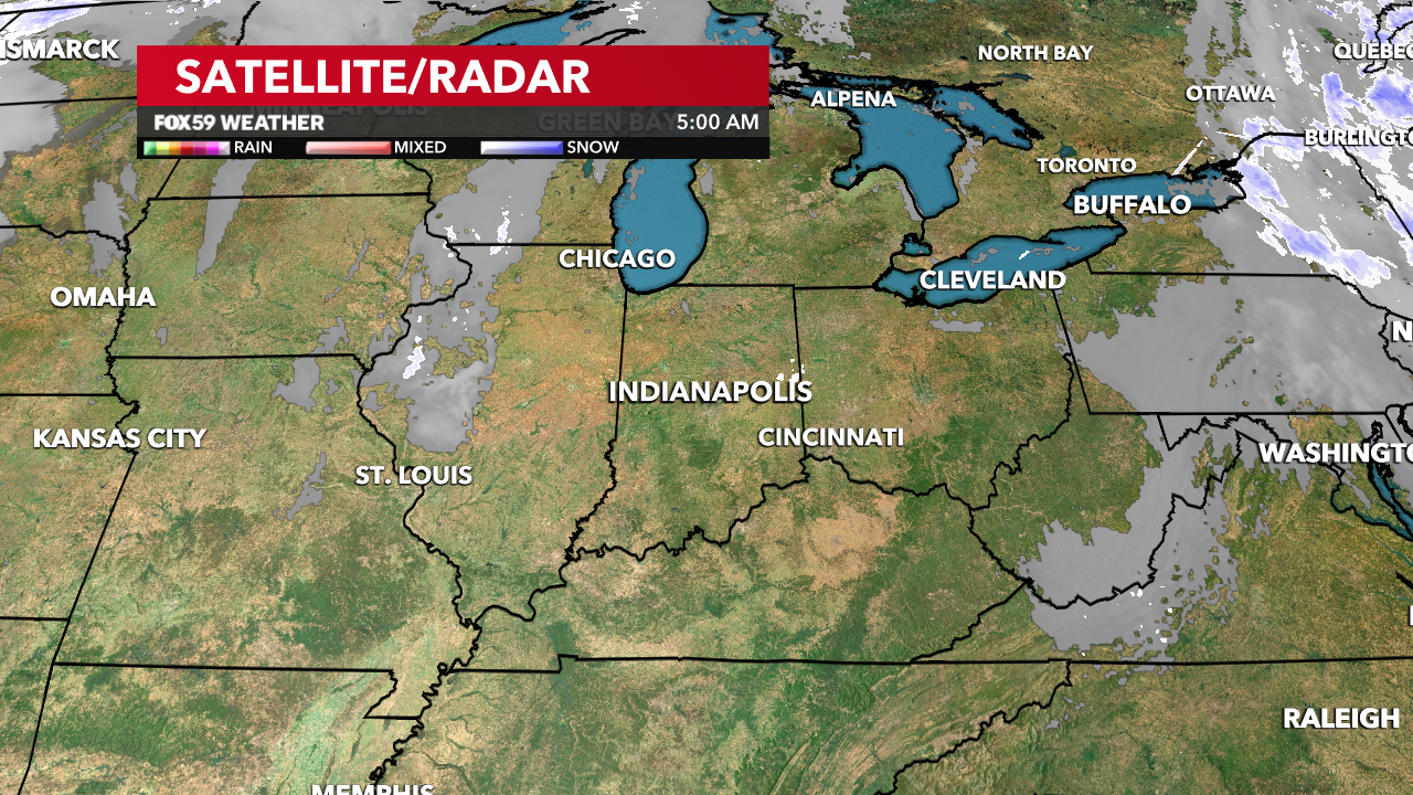
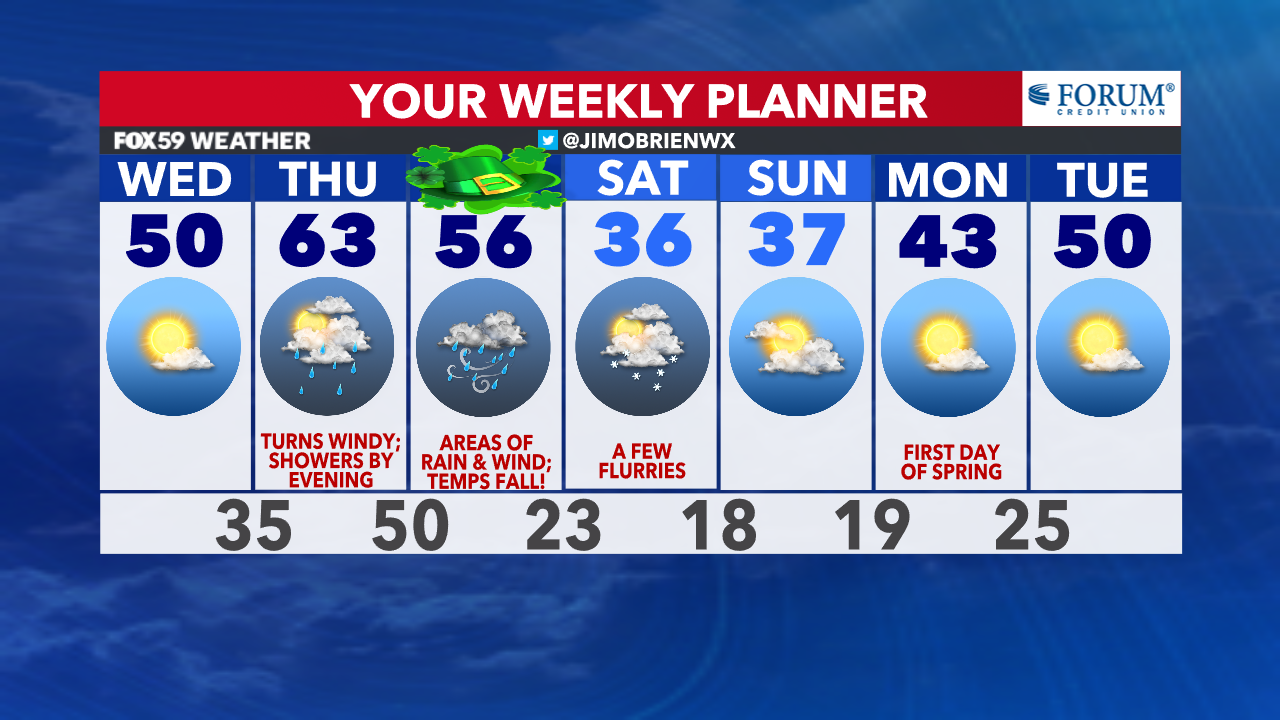
Skies are clear and conditions frosty to begin our hump day morning! Off to a cold start, in fact, the coldest in three weeks (February 24), as temperatures are now hovering in the lower 20s. Expect a bright sunrise and light winds to begin our day.
This afternoon, a steady rise in temperatures will bring us back to seasonal levels, while winds remain steady but light from the southwest at 6-12 mph. Today will be the best of the week but not the warmest. Enjoy!

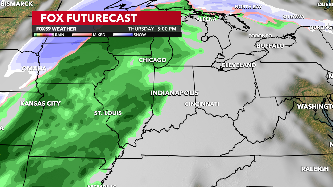
Thursday brings increasing clouds, windier conditions and additional warmth, as highs warm into the lower 60s. Showers will begin to build in by late afternoon and into the evening, while temperatures hold steady. Heavier and steadier rain will build into the overnight with rainfall ranges between .30″ to .60″ in spots.
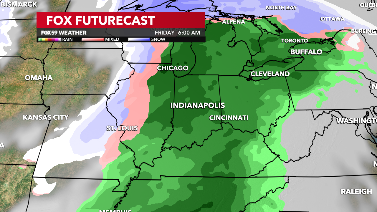
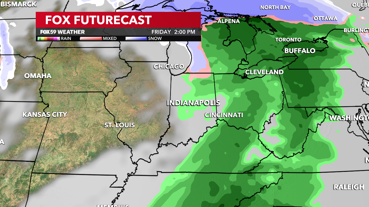
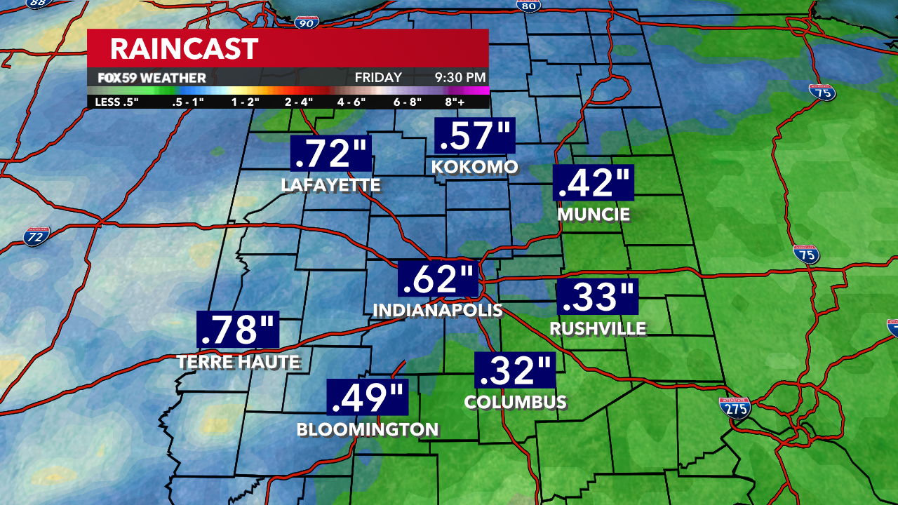
St. Patrick’s Day starts wet and windy, as temperatures begin to slide downward through the morning and into the afternoon. After morning highs in the 50s, expect most of the afternoon in the 40s, along with strong gusts, as wind chills become a factor.

Comments are closed.