
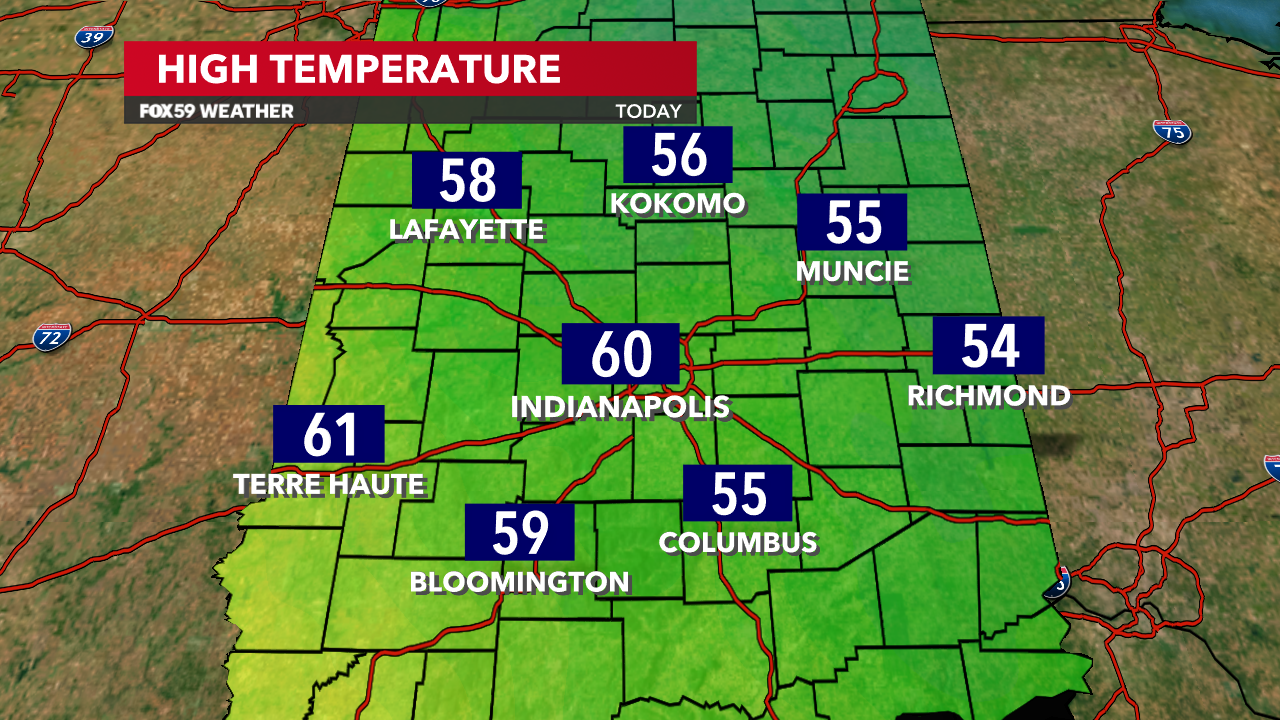
Indianapolis recorded its fourth day of 60s so far this February! This continues the very mild month and mild winter we’ve had across Central Indiana. While both Meteorological Winter and February end on Thursday, we’ll have more warmth and storms before a big drop and some snow perhaps before that time! Yes, another roller coaster ride is in store this week.
Warmth to start the week, 2024’s first 70s possible
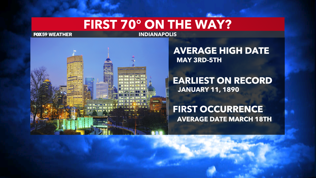
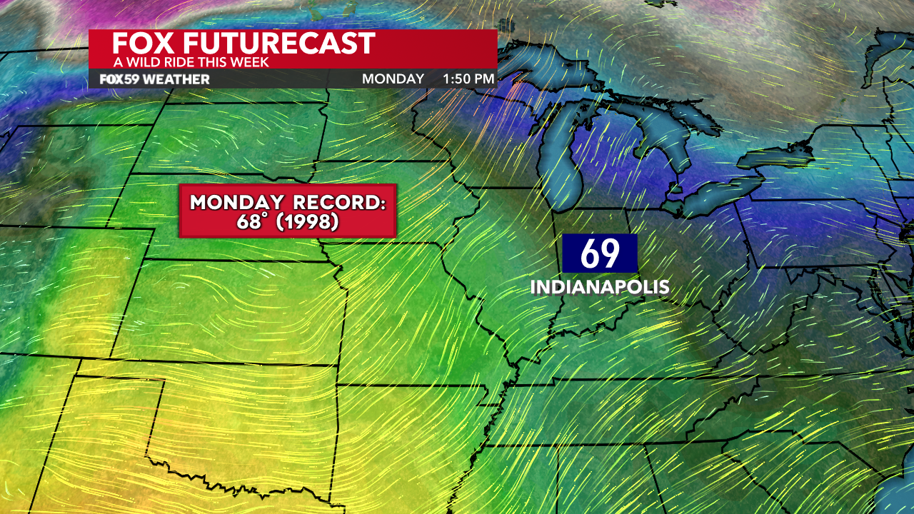
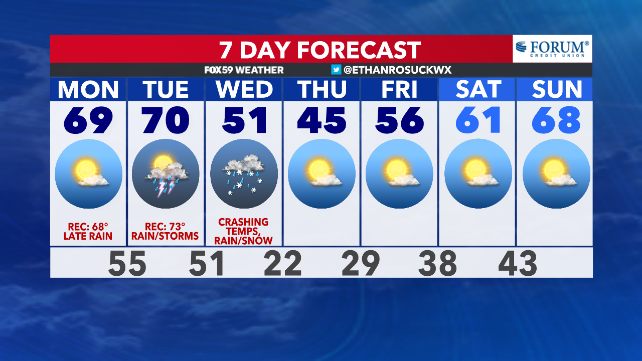
February 2023 had one day of 70s and it’s likely 2024 will follow in its footsteps. With the abundant sunshine and dry grounds Monday, the forecast high of 69° may not only break the current daily record but we could realistically hit 70°! Monday gets the go-ahead for spending time outside as Monday calls for abundantly sunny skies.
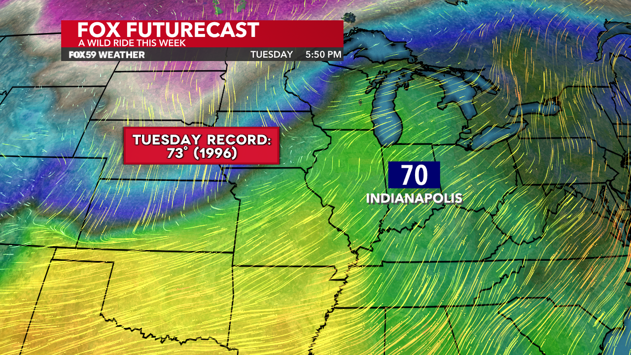
Tuesday’s forecast high of 70° would put it just shy of the record. These numbers are normal for the beginning of May and occurrs around March 17-18 on average for the first time. These are the years that a one or more 70s occurred in February for Indianapolis…
| February 2000 | 3 |
| February 2017 | 2 |
| February 2023 | 1 |
| February 2018 | 1 |
| February 2016 | 1 |
| February 1999 | 1 |
| February 1996 | 1 |
| February 1985 | 1 |
| February 1972 | 1 |
| February 1954 | 1 |
| February 1932 | 1 |
| February 1922 | 1 |
| February 1896 | 1 |
| February 1883 | 1 |
Then we turn stormy with a severe potential
At the conclusion of the daytime Tuesday, clouds will be on the rise and rain chances will begin to increase. There will be showers and storms throughout Central Indiana but there are still many things up in the air, even two days away. Below are our current thoughts on the severe weather potential.
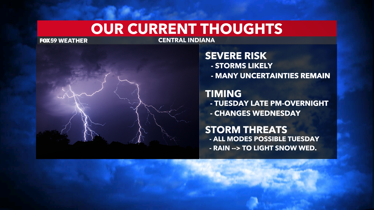
You will notice, especially on Tuesday that it will be “muggy” for February standards. Dew points will surge well into the 50s, with perhaps a few 60° readings possible. Moisture is a big component when it comes to storm development. Because it’s February and we’ll have those moisture levels, that will serve as an ingredient although the levels are low overall. We’re thinking that showers will arrive overnight Monday into Tuesday morning before a potential midday break. Then, the main threat for severe weather looks to be Tuesday late afternoon into the overnight hours.
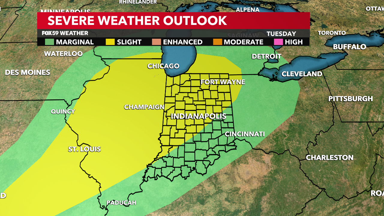
The Storm Prediction Center, as of this writing has most of Central Indiana under a level two Slight Risk for severe weather. The exact timing, exact track, area coverage and plenty more remain to be seen at this point. Nonetheless, all modes of severe weather are possible late Tuesday into early Wednesday morning before a cold front arrives. Gusty winds, hail, a few tornadoes and heavy rain are all in the cards at this time. This will be further narrowed down in the hours ahead.
Now is the time to keep an eye on the forecast as we get closer. February does have a history of producing some nasty storms but this is something we’ll monitor throughout Monday/into Tuesday.
Cold front makes temps CRASH, although it will be brief
Highs in the 50s will be very early Wednesday before the cold front makes our temperatures plummet. Cold air advection will rush in with the cold northwest flow. We’ll get rid of the somewhat moisture-filled air and replace it with a very dry airmass from Canada.
The daytime Wednesday will likely start as rain but some back-end snow showers later in the day are possible. That will all depend on how quick the cold air rushes in and how quick our temperatures drop.
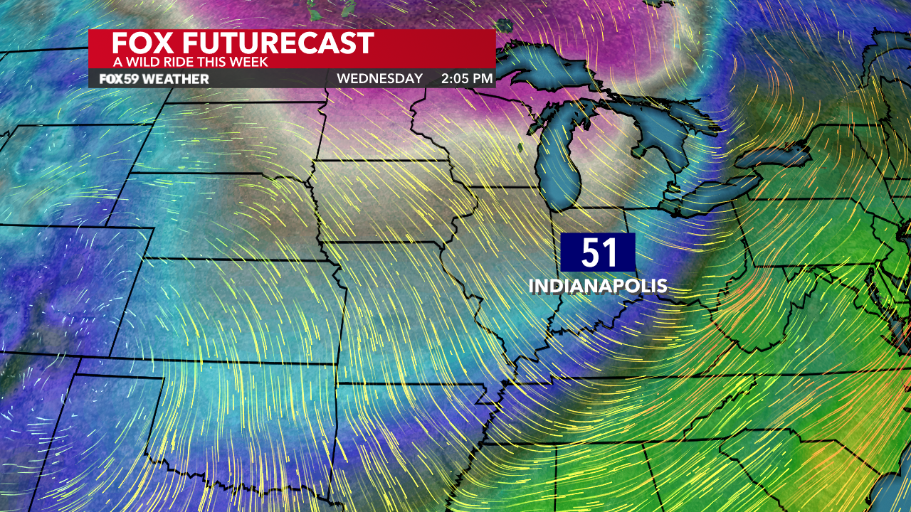
Highs in the 40s will be the story Thursday before we rebound AGAIN to open March on Friday. More sunshine and extended warmth is in store for next weekend. For now, keep an eye on The Weather Authority for the latest on Tuesday PM-Wednesday AM storm threat.
Comments are closed.