
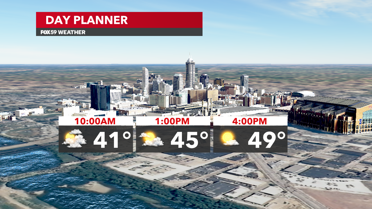
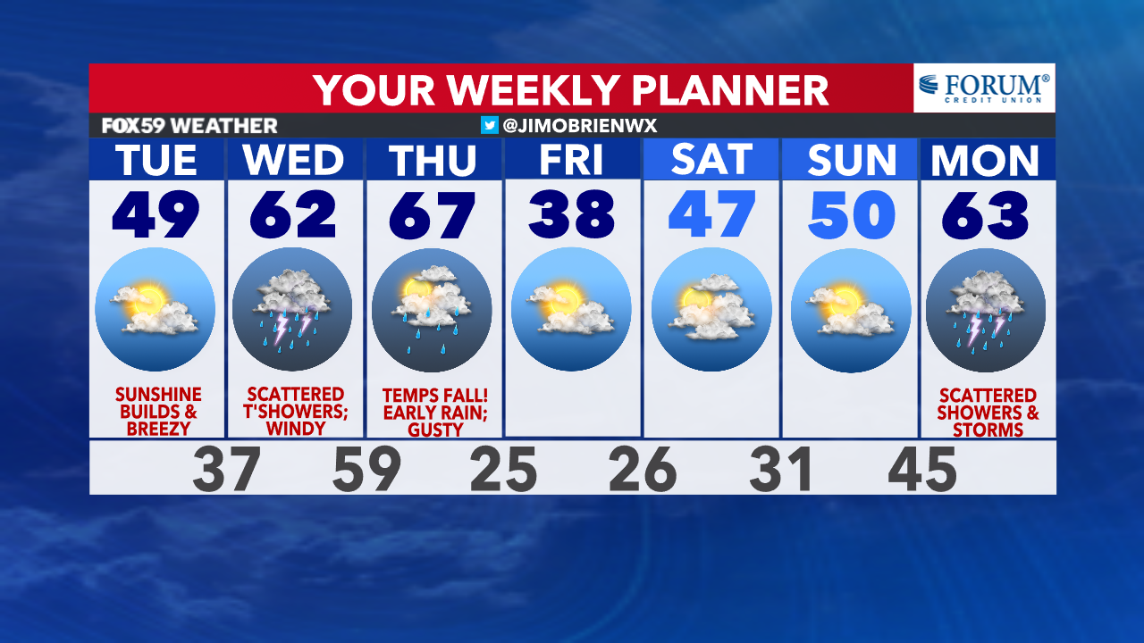
Expect a few pockets of showers and sprinkles around this morning, as a cold front passes across the state. Any light rain will be gone by mid-morning (after 8 a.m.), followed with increasing sunshine and a breezy west wind through the afternoon. This front will bring a cooler flow, compared to Monday but still a day remaining above the seasonal averages, as highs reach near 50°.
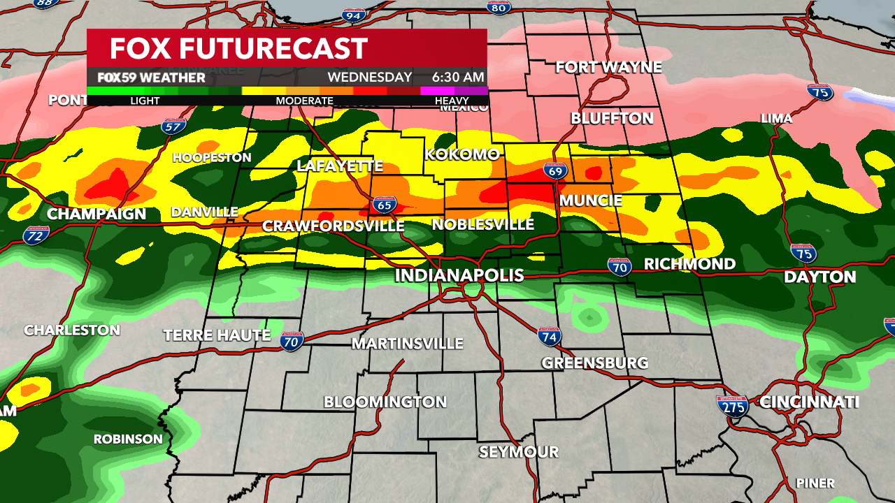
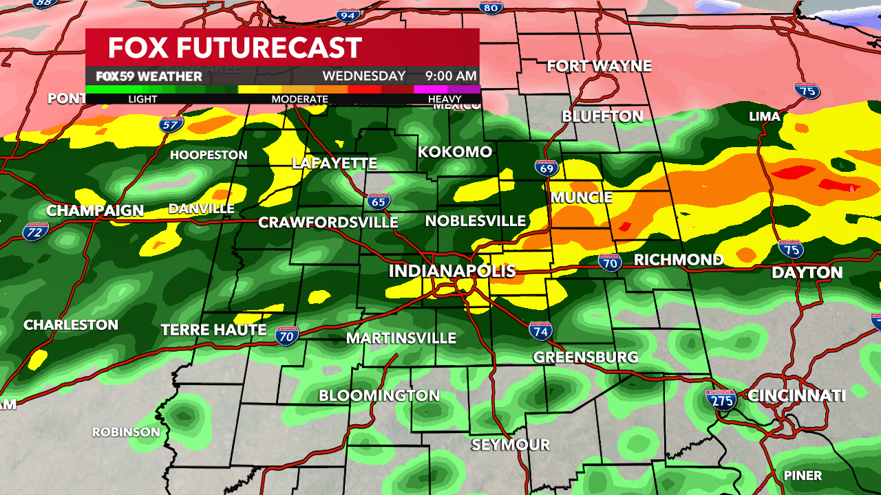
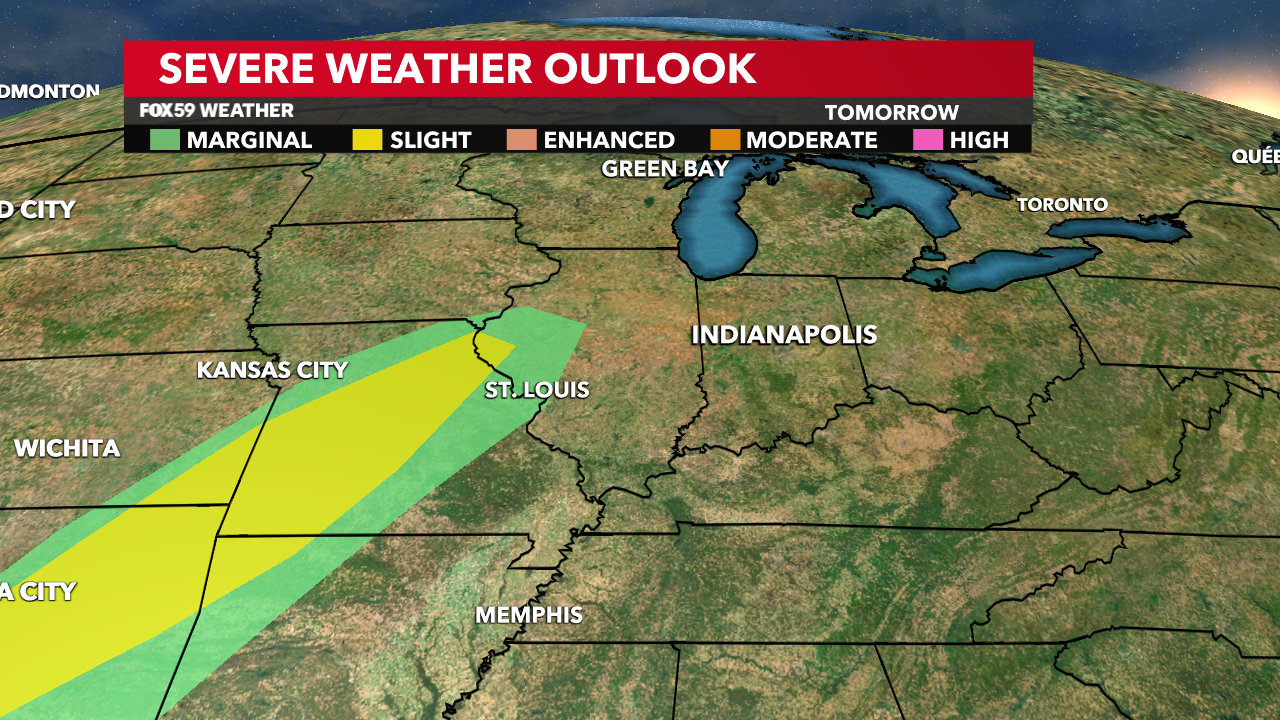
Tonight, clouds will build back in and thicken overnight, as rain chances return to the state. Overnight rain and thunderstorms will begin to work in from the southwest and bring heavier downpours and lightning through Wednesday’s morning rush hour. The severe threat is quite low with lightning and a stronger gust around, maybe some small hailstones. To our north, at the onset, some wintry mix could create slick conditions before warmer air overruns that area by mid-morning.
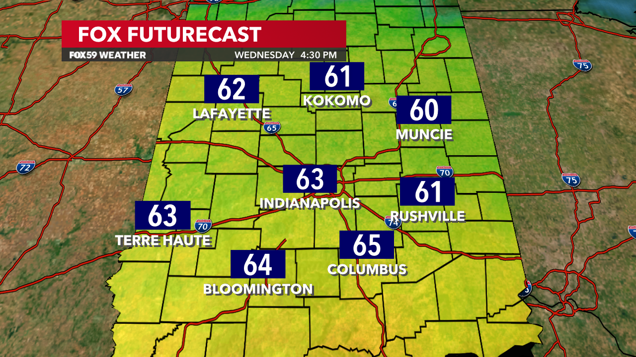
Additional rain and storms will remain off and on through the day, while winds turn gusty from the southwest. Under this flow, temperatures will surge bringing highs in the lower to middle 60s by late afternoon.
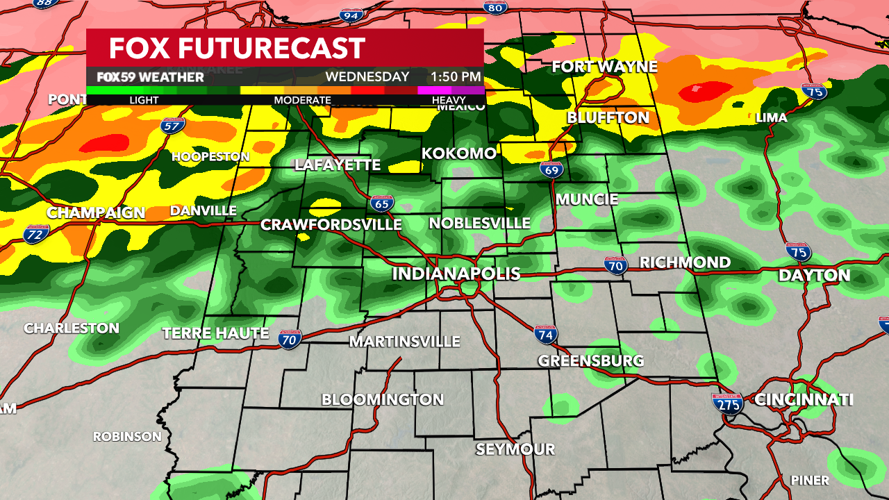
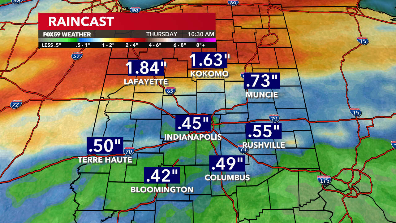
More warmth and rain will continue through early Thursday morning, as temperatures remain in the 60s but begin to fall through the morning hours. Rainfall (2-day) totals for Wednesday and Thursday will likely range between .50″ to 1.50″ for central Indiana before colder, more stable air returns to the state.
Comments are closed.