
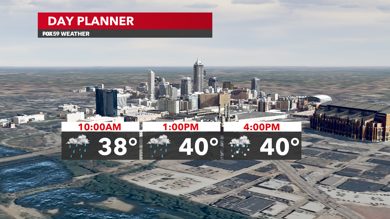
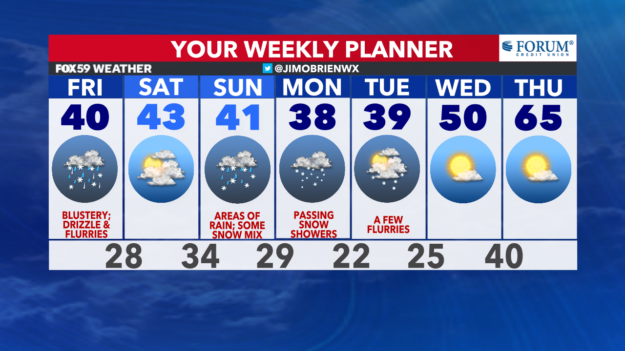
Cloudy skies, patchy drizzle and cooling temperatures are underway! With a passage of a cold front this morning, winds will increase and chillier air will settle in for the late morning and afternoon. Pockets of drizzle and some flurries will mix in throughout the day, but roads will be fine as temperatures will remain in the upper 30s to lower 40s through the evening. Blustery conditions today will add to the winter “feel,” as wind chills dip into the 20s at times.
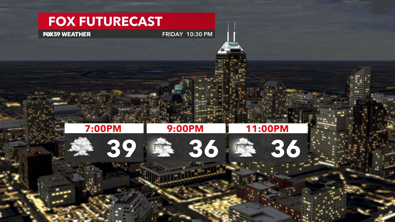
Tonight, drier air punches in, as clouds break late and temperatures drop into the upper 20s by sunrise Saturday.
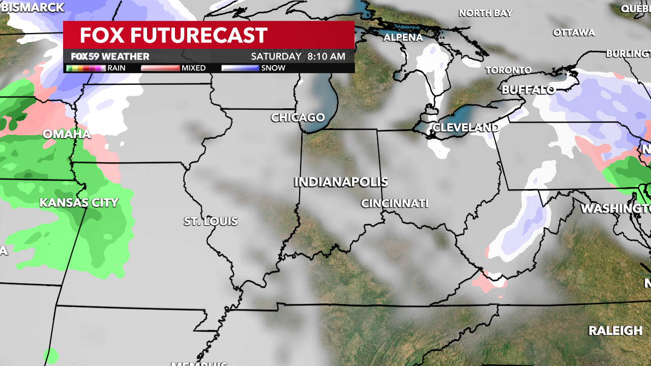
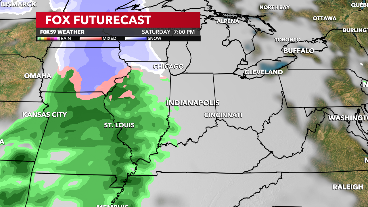
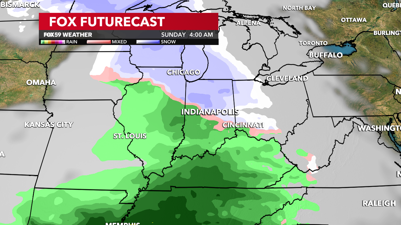
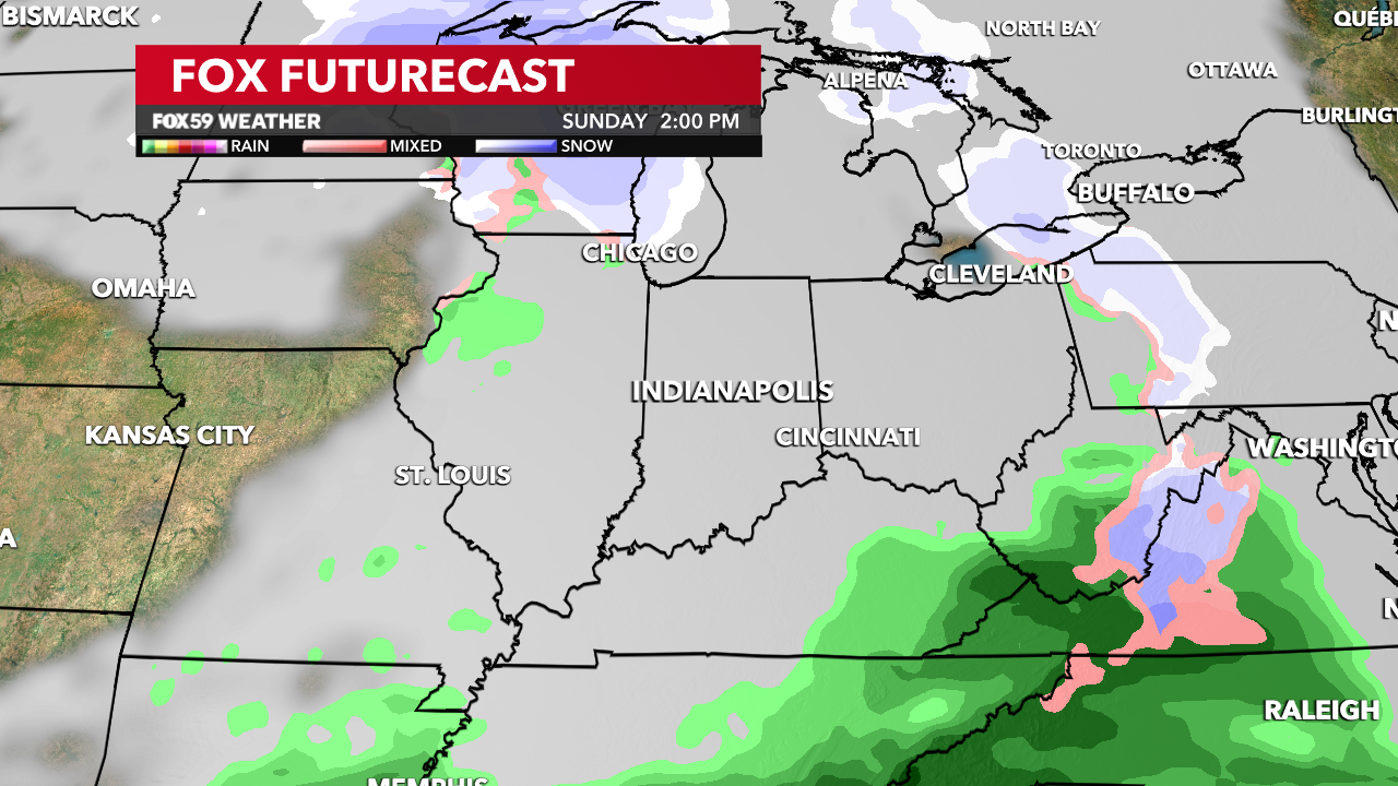
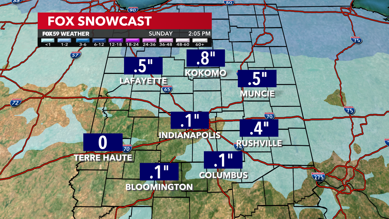
Tomorrow will bring dry weather and some limited sunshine for the front end of the day. Eventually, clouds will be increasing again, as a new system approaches for the evening and into the early hours of Sunday morning. Snow chances will rise a touch, along with rain mixing for the front end of your Sunday. Some slushy accumulations will be possible for areas, mostly north of downtown Indianapolis.
A reinforcing shot of cold air coming for Monday and Tuesday, as winter lingers with passing snow showers and lake-effect snows for parts of the state.
Comments are closed.