
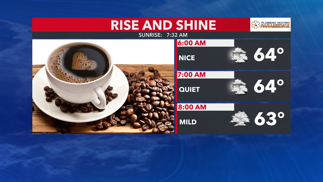
Clouds have increased in the overnight, as rain showers have gathered in western Indiana and Illinois. The added cloud cover has kept our temperatures milder overnight, so there is no need for a jacket out the door!
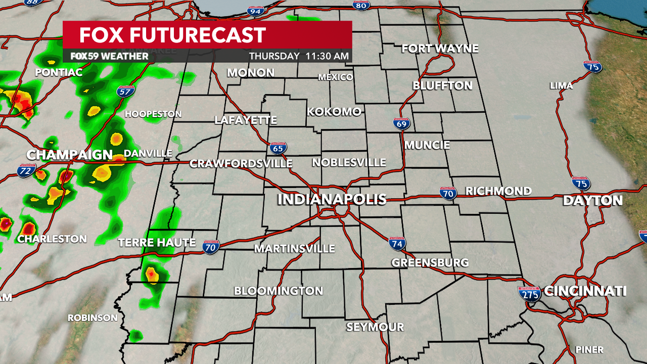
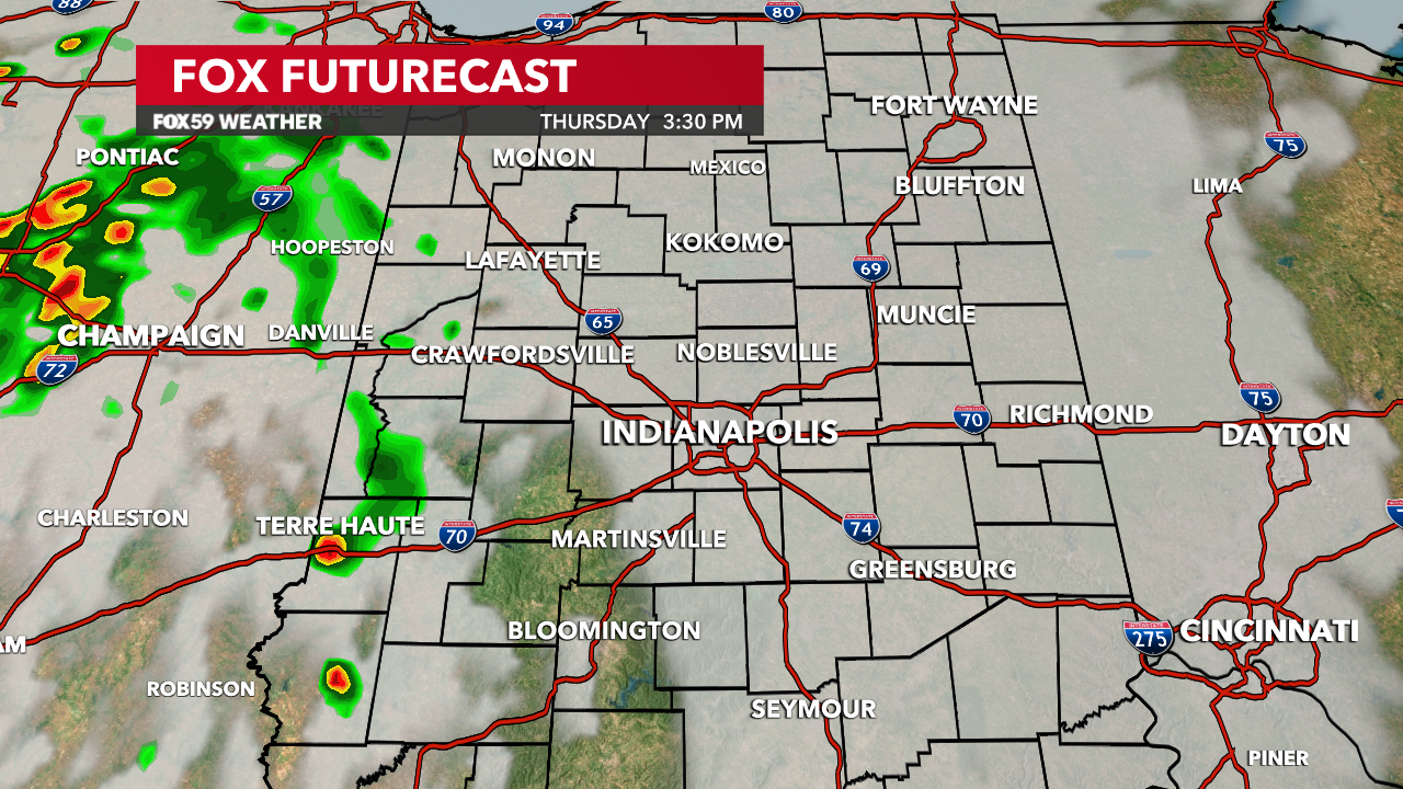
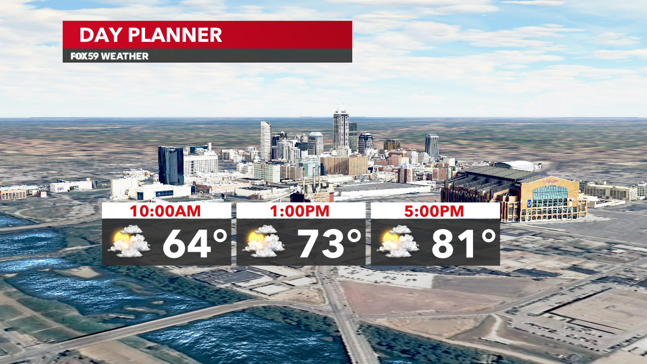
Great to see rain on the radar but unfortunately, none of this activity will make it into central Indiana. The best chances will hold from Evansville to Terre Haute and west of Lafayette. A few showers may advance a touch more to the east but are likely not to reach Indianapolis through the late afternoon. Highs will reach the lower 80s locally, slightly cooler than yesterday
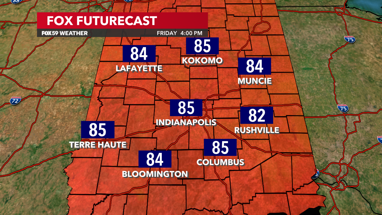
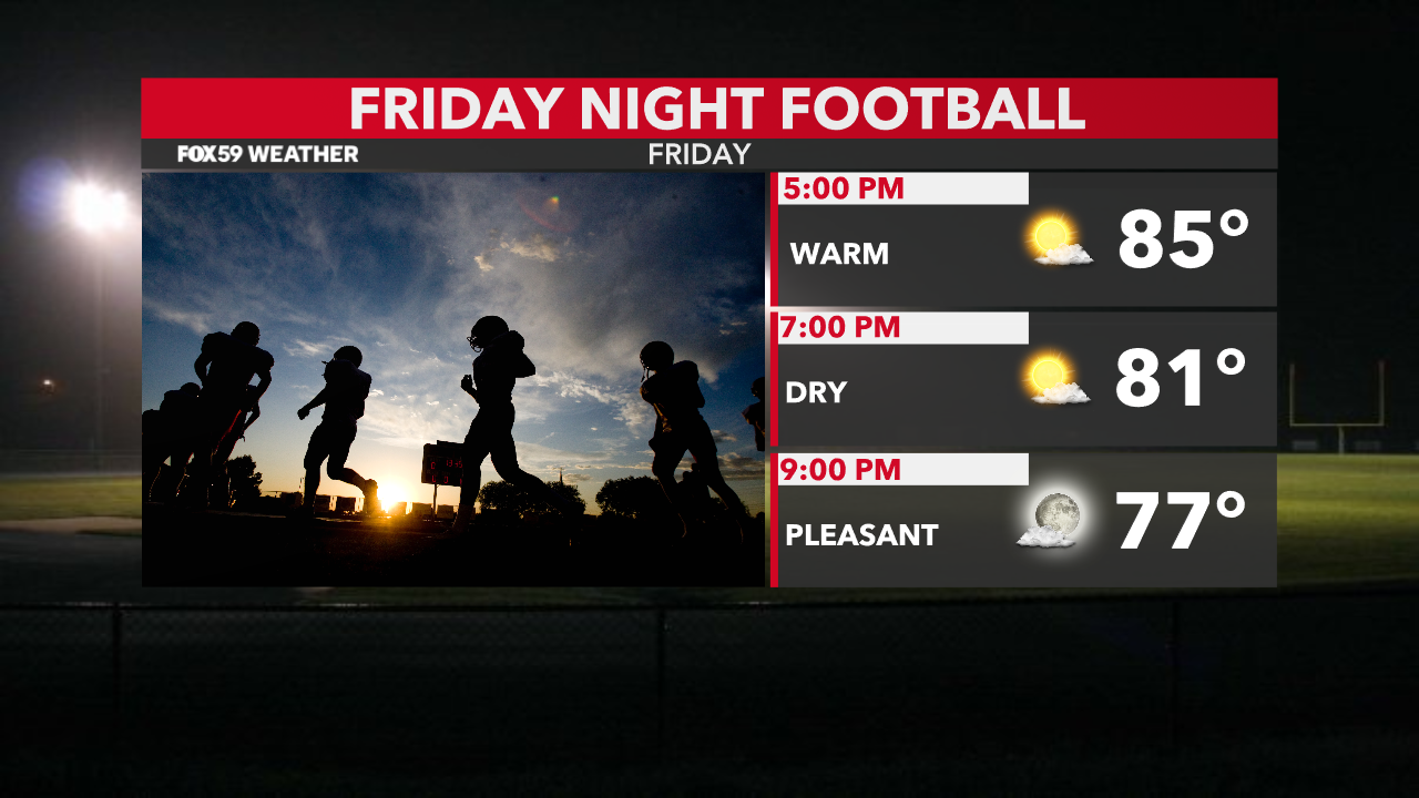
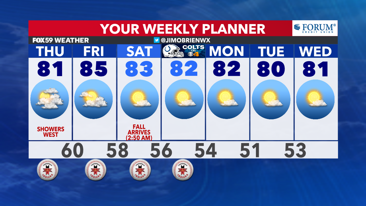
Friday brings a return to sunshine, and this will provide a warmer day to end the workweek, as dry weather holds steadfast for Indianapolis and surrounding cities. Expect highs in the middle 80s by late afternoon.
A Canadian high returns for the weekend, as a developing storm off the east coast will slow the weather patterns and bring a return to northeasterly winds. This subtle change in wind direction will push lower dew points and much drier, cooler airflow. Unfortunately, rain chances remain obsolete as the drought worsens across the state
Comments are closed.