
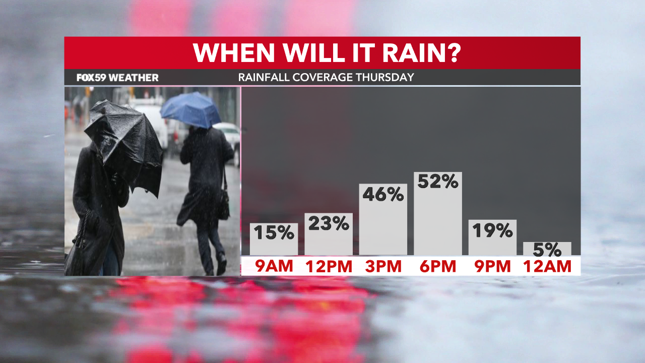
Back-end moisture brought scattered rain and snow showers to Central Indiana Thursday morning. You can expect more of the rain showers at times throughout the day as it will continue feeling more like February instead of April 4th.
Breezy, cooler and rainy Thursday
Wind chills in the 20s as you head out the door won’t improve much through the day. Jackets will be needed throughout the day. Thanks to cool Canadian northwest winds, highs will struggle to get out of the upper 30s/lower 40s. Clouds will also stick around.
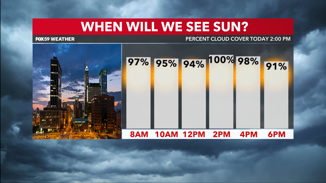
Not to mention that today calls for scattered rain/snow showers at times. Dry hours are promised but any precipitation chances will be scattered. Precip will get out of here tonight and we’ll start to clear our skies out late once that low-pressure center continues moving east.
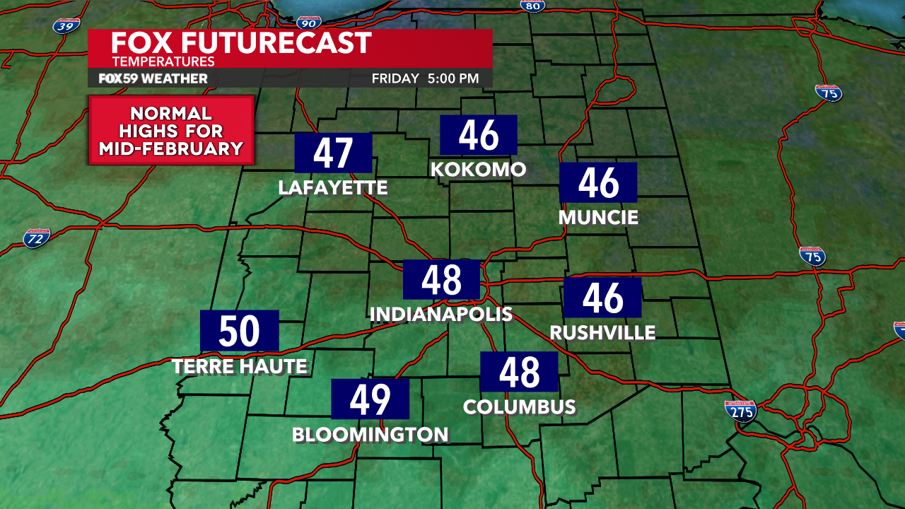
Improvements start Friday
Things will start to dry out late Thursday and overnight. Clouds will exit late but temperatures will still be below normal Friday. Highs in the mid-to-upper 40s are likely.
We could see a few sprinkles Friday afternoon but the chances of that are very low. After that, high pressure moves in and sets Central Indiana up for a quiet start to the weekend. A hard freeze is possible Friday night if the winds lighten up enough.
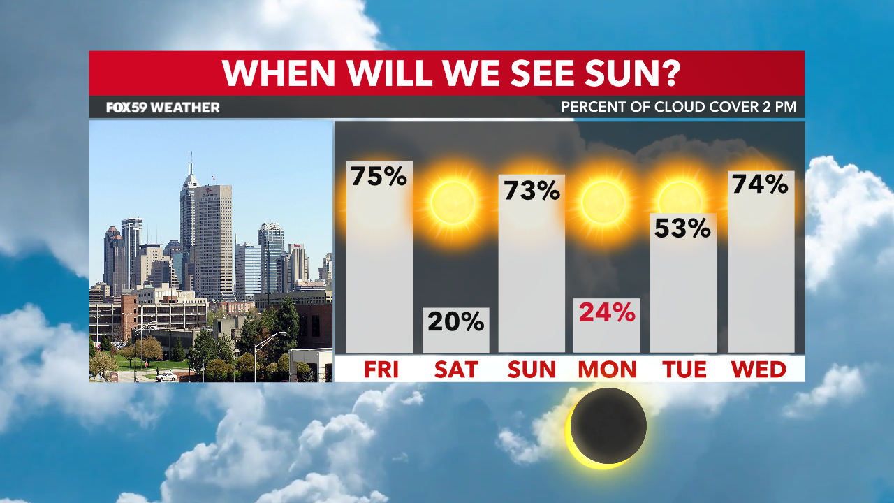
Saturday also looks to be sunny with highs in the 50s before clouds move in late.
System to Bring Rain Before Eclipse
A system currently out in the Pacific Ocean will bring our next rain chances for Sunday into the very early hours of Monday. With this in mind, we’re hoping a warm front and dry slot moves in for Eclipse day on Monday. This would aid in some clearing for eclipse viewing on Monday afternoon. Not to mention that increased southerly flow will make Monday the warmest of the next week with highs flirting with 70°.
Comments are closed.