
Saturday featured another day of no clouds in our skies, continuing the trend of a very sunny November. We’ll have another nice day Sunday as we turn even milder thanks to high pressure sticking around the Midwest. But as we approach Thanksgiving, well-needed rain chances and a cooler pattern both will arrive in the coming days.
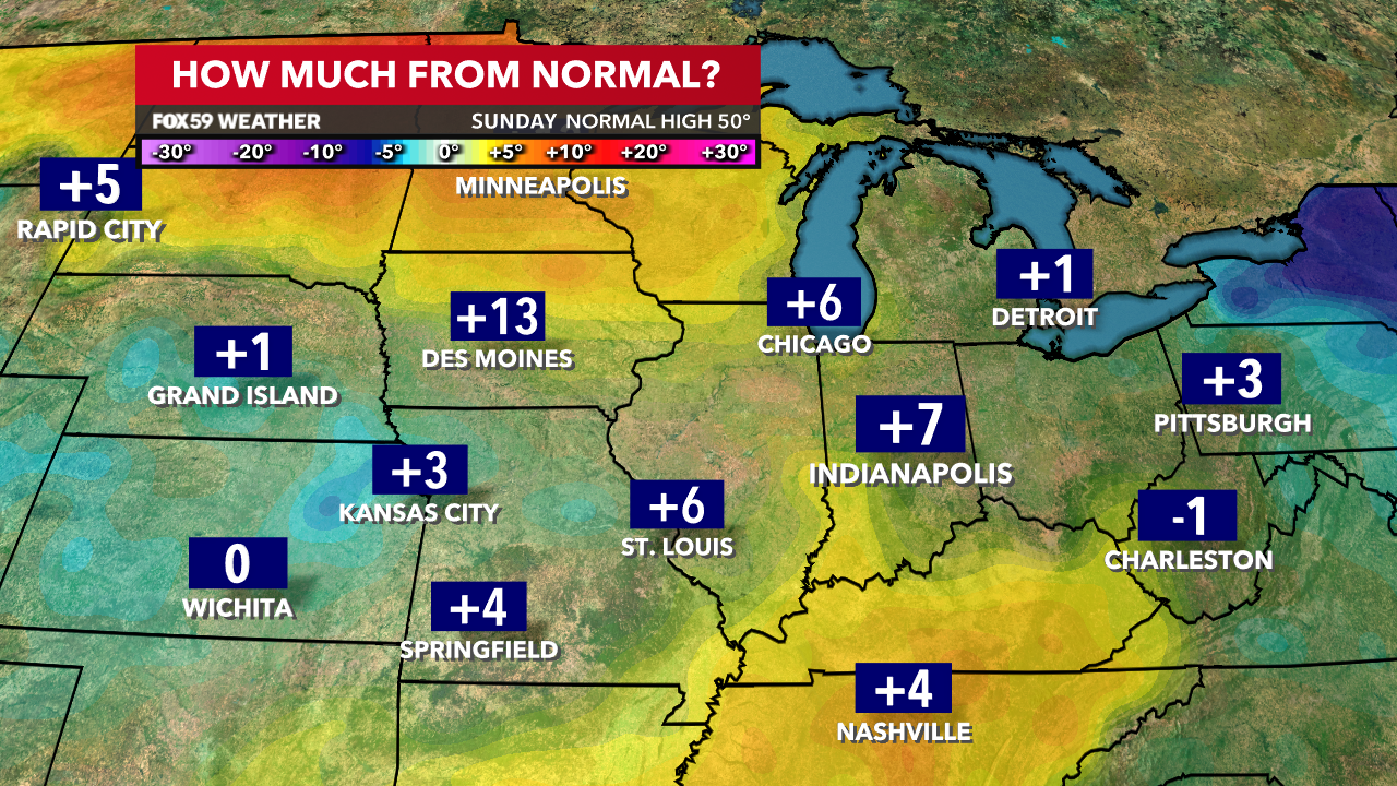
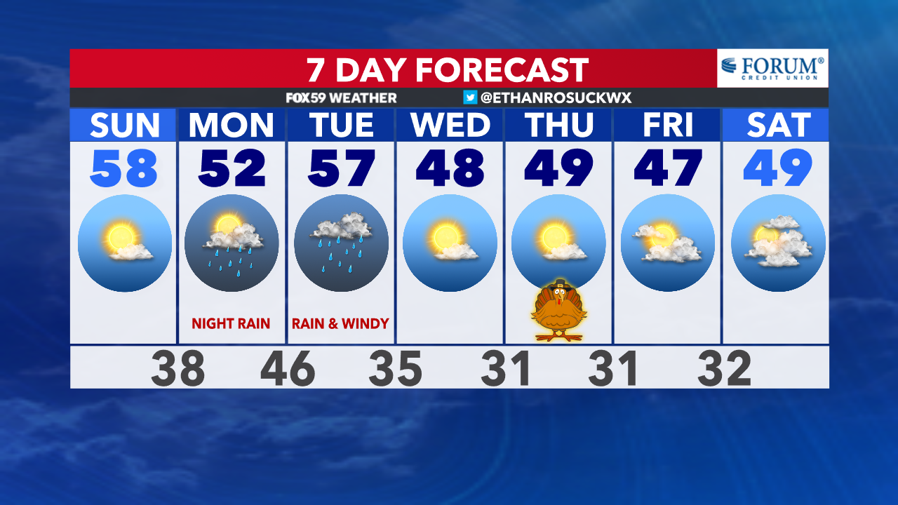
Expect highs on Sunday in the mid-to-upper 50s across the region, a good 5-8° above normal for this time of the year. Mostly sunny skies will be the name of the game, too. Skies will cloud over late and turn overcast on Monday. This will be ahead of our next frontal boundary which will bring rain here.
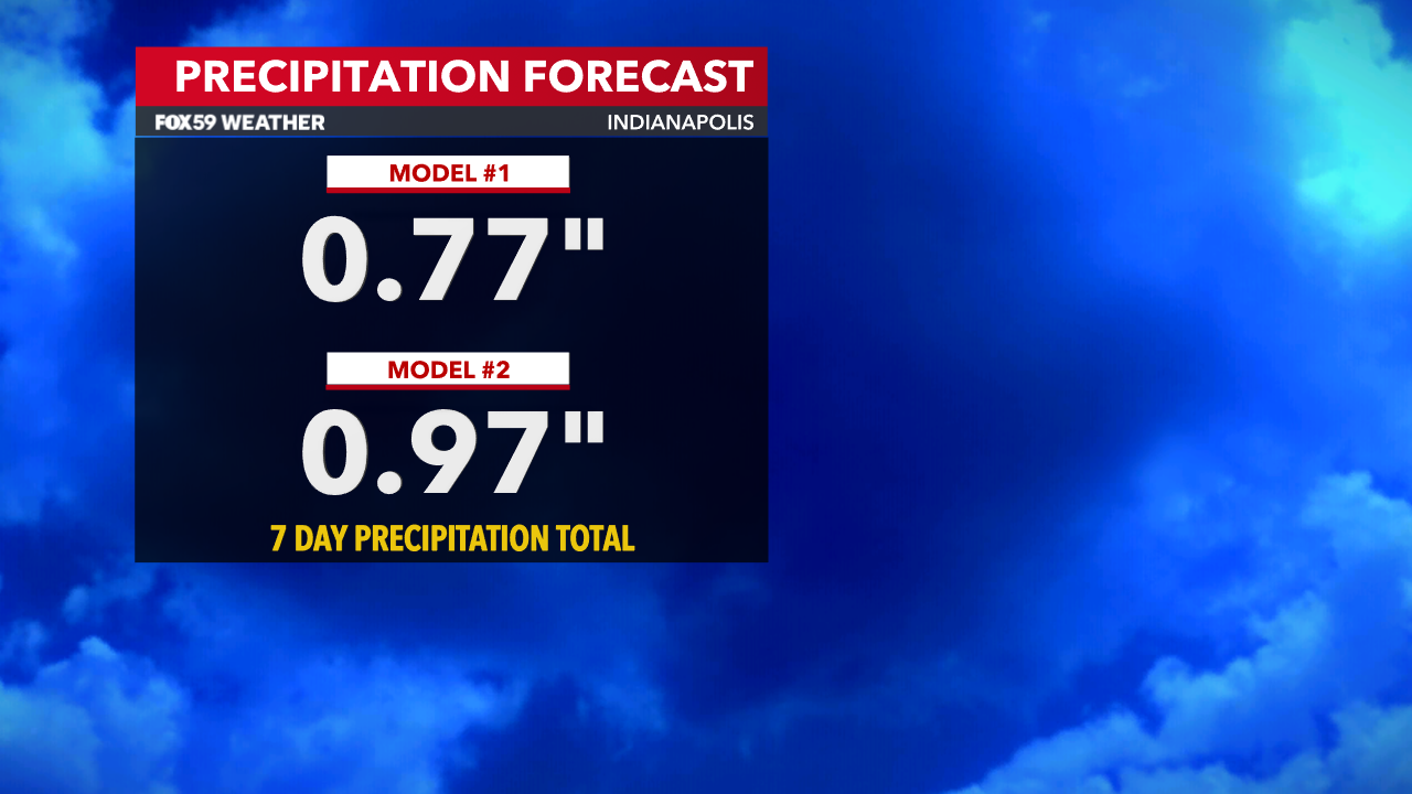
Before the frontal passage, highs on Monday will be seasonable in the lower 50s. Rain chances go up in the afternoon but the higher chances exist at night and overnight. Rain will move in from south to north. Most of Tuesday will also be rain-filled but the rain will exit throughout the day. We expect most spots to potentially receive 0.5-1.25″ of needed rain. The higher rainfall potential exists south of Indianapolis. Indiana will take any rain it can get because it’s one of the driest Novembers on record. If November ended today (Saturday as of this article), it would be the third driest November ever.
Over the past few days, we’ve monitored a cooler trend just in time for Thanksgiving. However, thanks to this cold front moving away from the Midwest faster, it won’t be as cold as initially thought. Nonetheless, a colder air mass will move in behind the front for Wednesday. It will only feel slightly below normal for this time of the year but we’ll notice it more because it’s been so mild as of late.
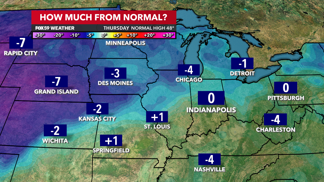
Highs Wednesday, Thanksgiving and into next weekend look to be in the mid-to-upper 40s. Lows will get well into the 20s for several spots at night. Luckily for the holiday itself, it looks to be quiet.
Comments are closed.