
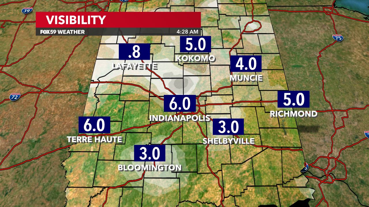
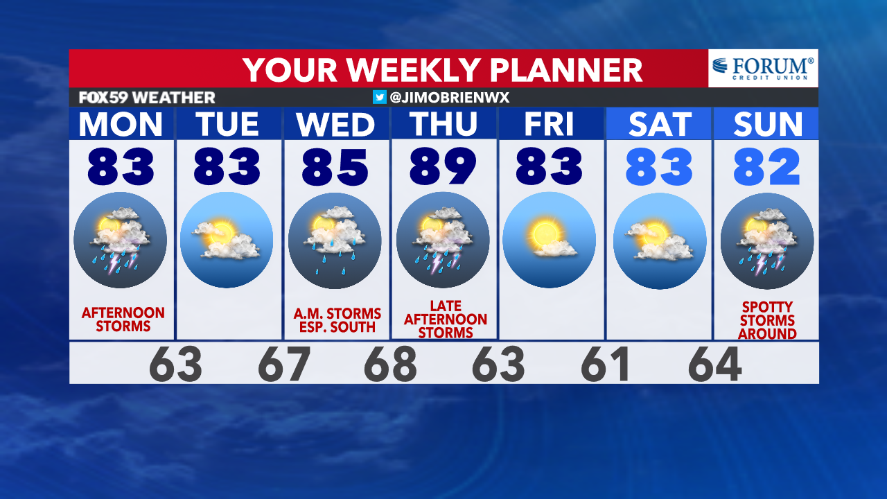
Off to a foggy, hazy, mild start to this Monday morning. Overall, dry weather is holding for now, while temperatures hold in the middle 60s out the door. Some fog is thick in spots but likely not enough to submit an advisory.
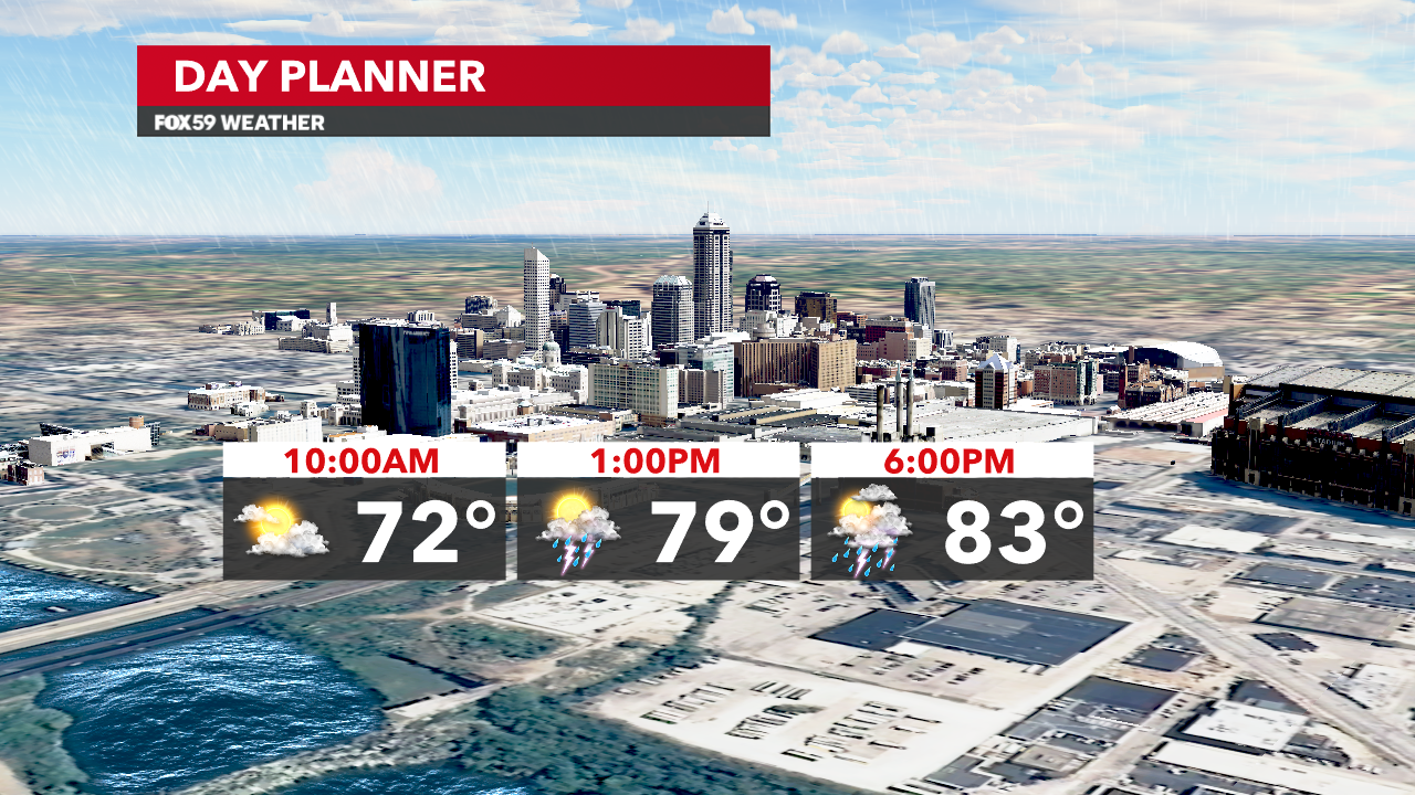
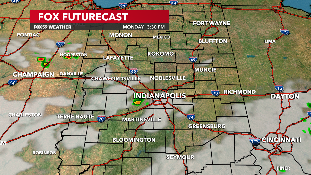
This afternoon, warmth will continue to build on southwest winds, as temperatures reach the lower 80s. Storm chances will reignite in the muggier air, as a cold front approaches from the northwest. The severe threat looks low for now, but a few storms could bring hail, lightning, and a gustier wind. Chances for showers will remain through the evening too before drifting off towards Ohio and eastern Kentucky.


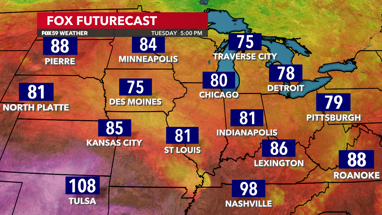
Drier, more stable air to return on Tuesday, as dew points remain muggy and highs hover in the lower 80s. Another Knozone Action Day is possible on Tuesday, as smoke from Canada continues to blow in from the upper winds overhead. Expect an update on this later today.
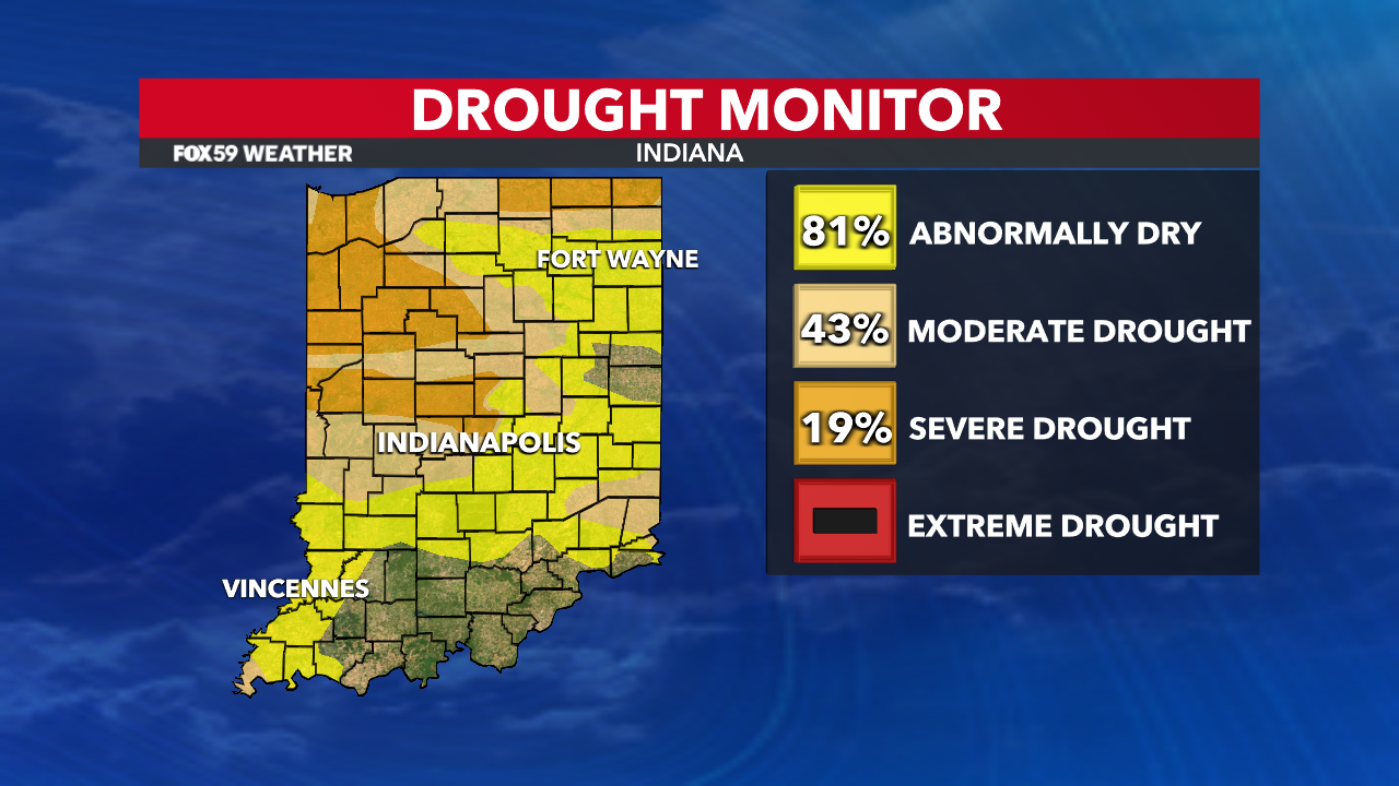
Additional storm chances will return early on Wednesday and another round possible on Thursday will add to our rainfall surplus for the month that remains much needed!
Comments are closed.