
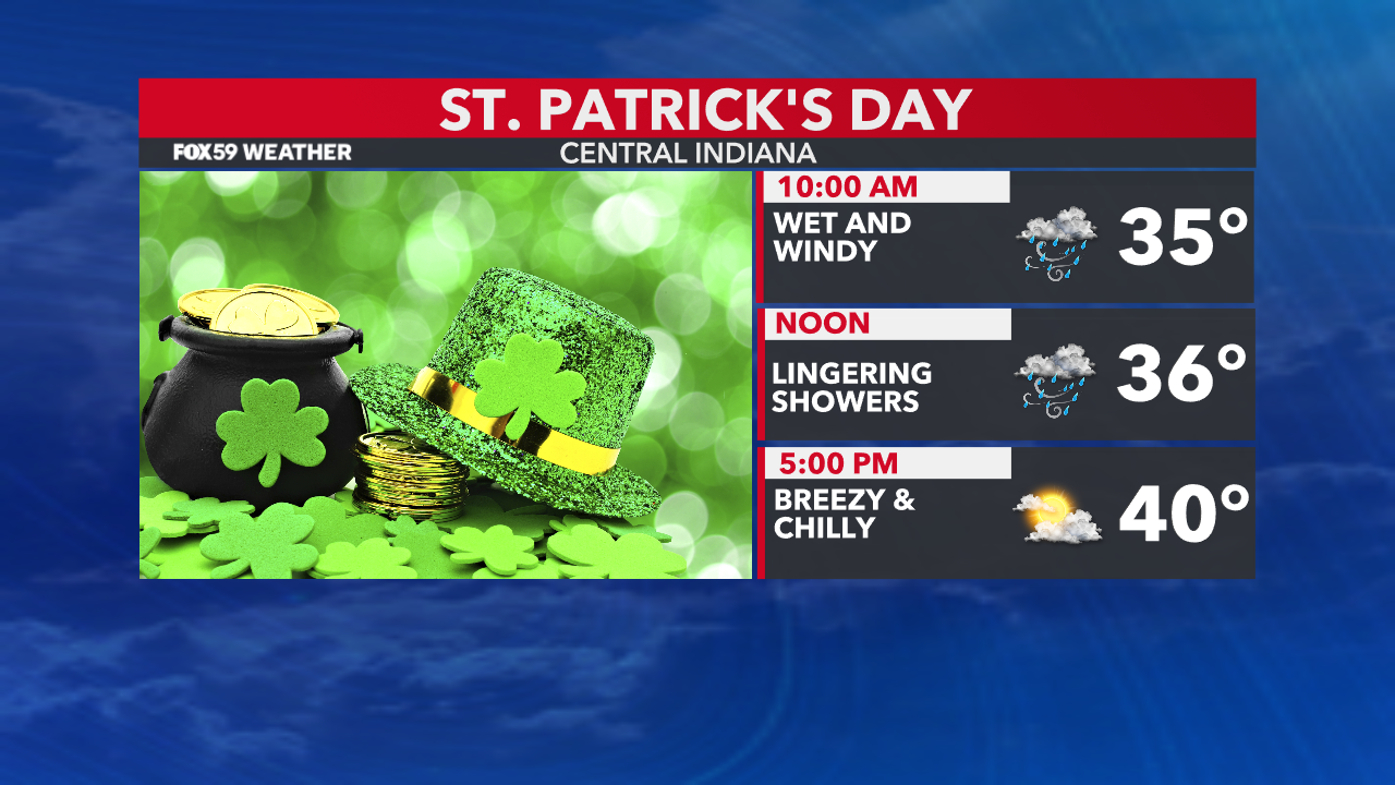
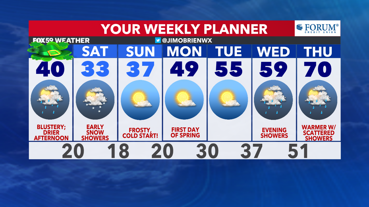
Areas of rain continue this morning, while temperatures are now tumbling! Winds continue to remain gusty, up to 35 mph throughout the day. Rain chances will begin to weaken by late morning, but patchy drizzle will remain through the afternoon, as colder air pours in statewide. Expect a blustery day ahead while wind chills remain in the 20s all day!
Tonight, skies clear and temperatures plummet into the lower 20s, with wind chills dipping into the single digits while clouds return to the area.
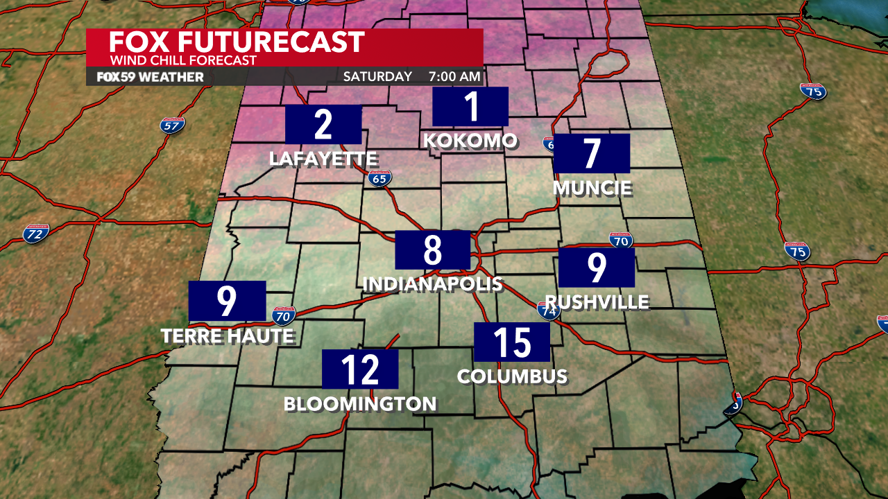
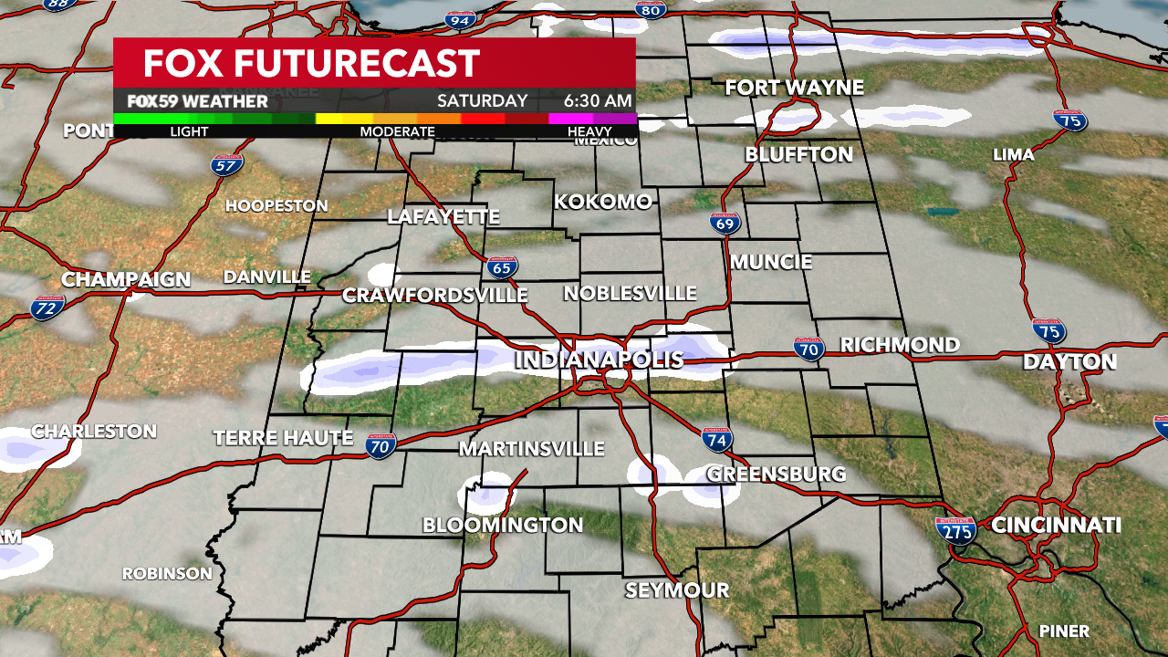
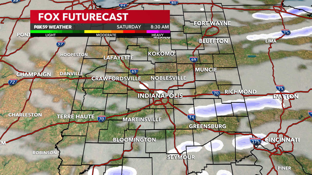
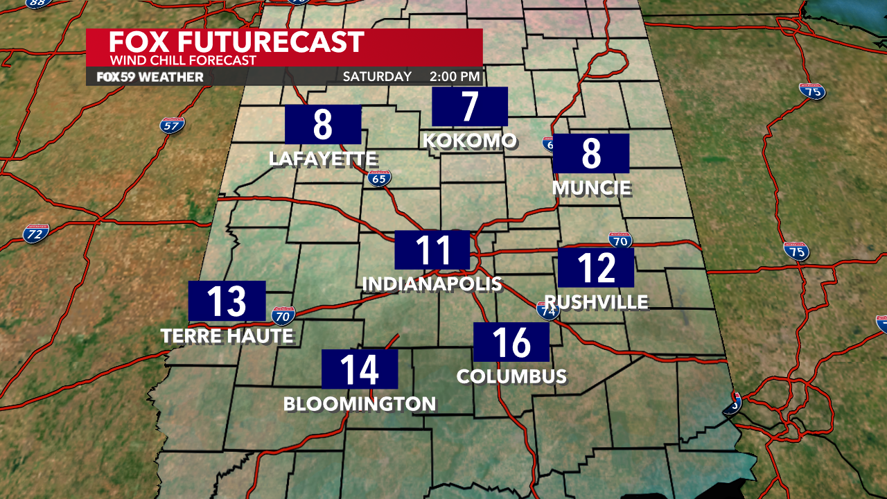
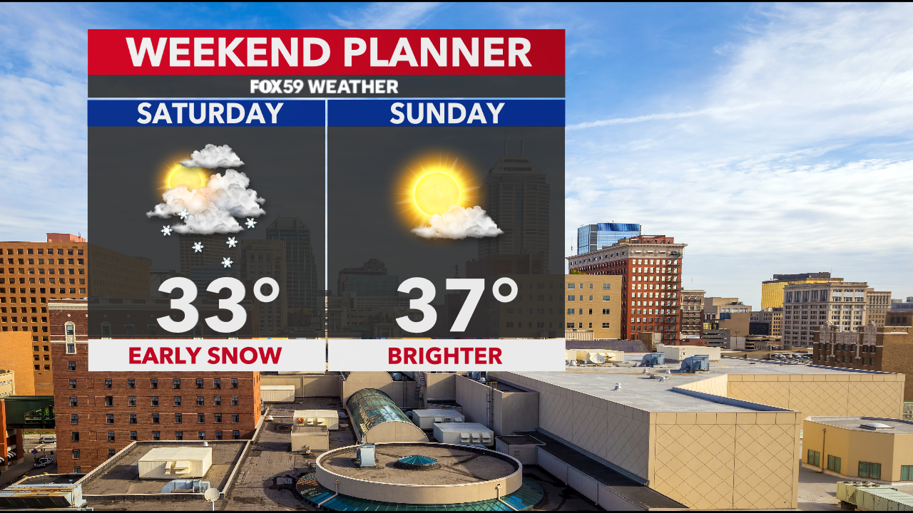
Saturday brings winter back! Pockets of light snow will be around early tomorrow morning, creating a few slick spots that will need to be monitored. Added clouds and gusty, northwest winds will mark a very cold day ahead with highs only reaching the lower 30s.
Calmer, brighter conditions return on Sunday after a frosty start! Expect milder air to return next week with sunshine building early in the week!
Comments are closed.