
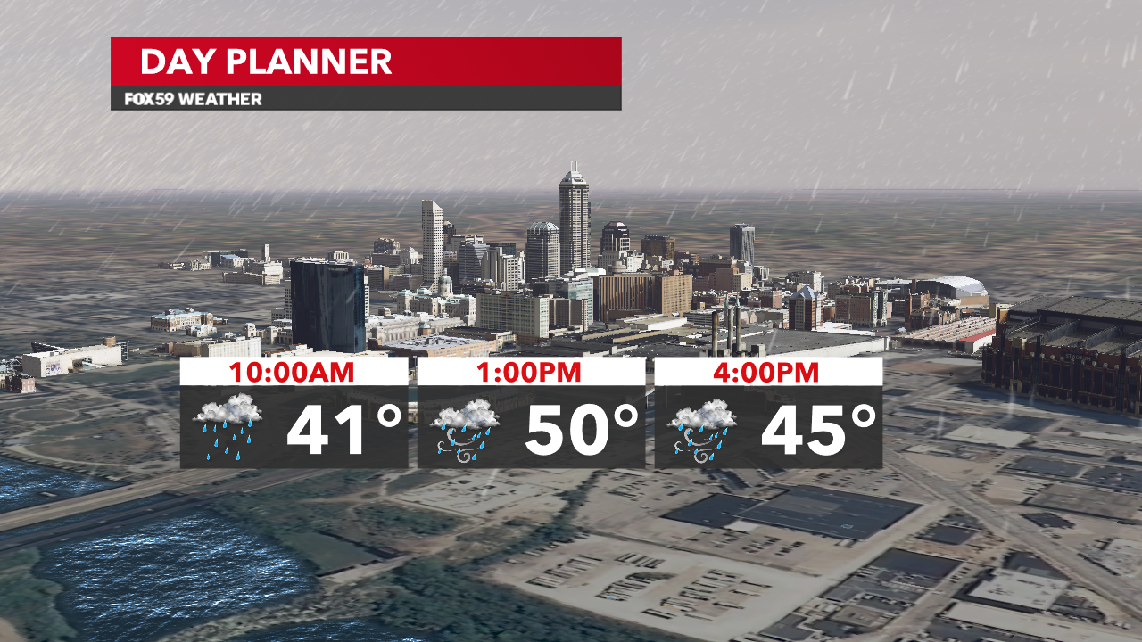
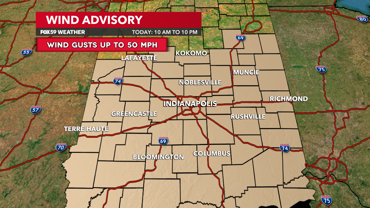
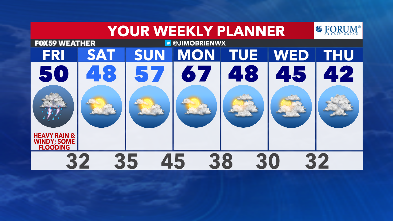
Rain inbound this morning, while winds increase and storms threaten this afternoon. Expect a wet morning rush hour, as rain fills in and intensifies through the late morning and into the early afternoon. Along with the rain falling, winds will begin to increase around 10 a.m. and continue through the evening with gusts reaching 50 mph.
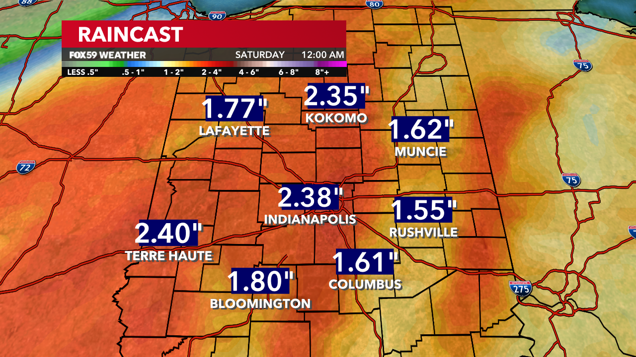
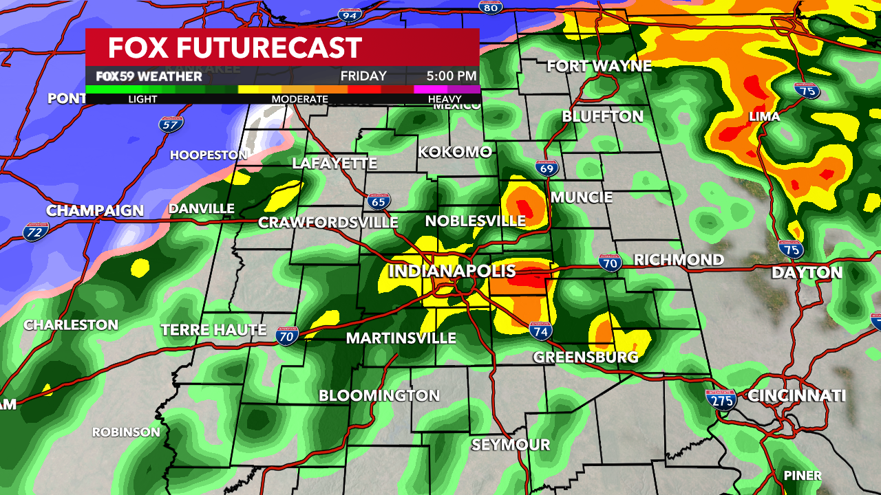
Aside from the rain and wind, a few storms will be possible this afternoon into the early evening, creating stronger gusts, lightning and a possible rotating storm. All of which will be monitored through the day! Rainfall potential remains in a range between 1 to 3 inches, with some flooding in lowland areas and along creeks and streams.

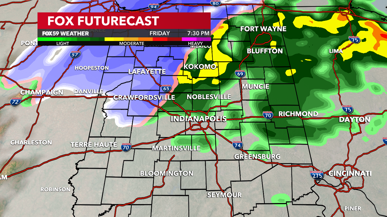
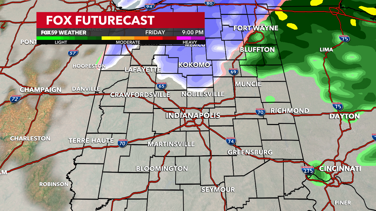
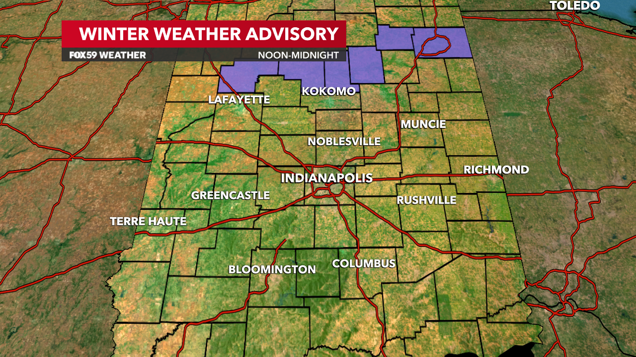
Tonight rain will continue, along with the wind, as colder air begins to encroach the area. This will bring a rain/snow mix locally with steadier, wet snow falling in our northern counties. Some accumulations possible for Cass, White and Miami counties. Eventually the mixed precipitations will come to an end, as colder, drier air works in overnight.
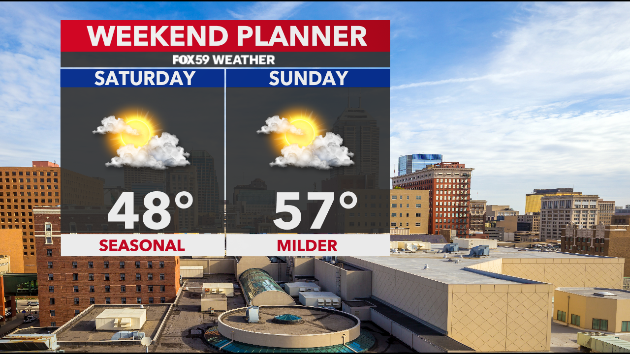
The weekend looks dry and much calmer with a cooler flow on Saturday, really a return to more seasonal levels. Sunday brings milder air, additional sun and a great finish to the weekend! Enjoy…
Comments are closed.